
MarineTraffic: Bootsnavigation5.9.1 - App Store
Sie können Ergebnisse sehen in einige Sekunden.
Herausgeberbeschreibung
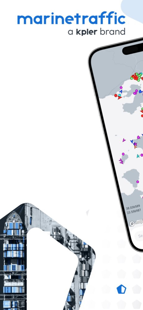
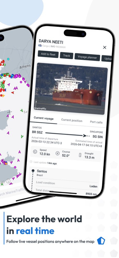
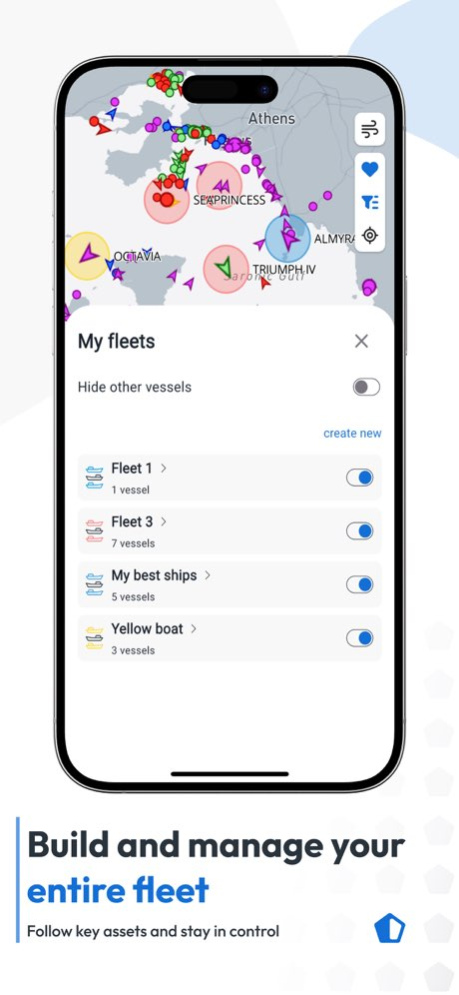
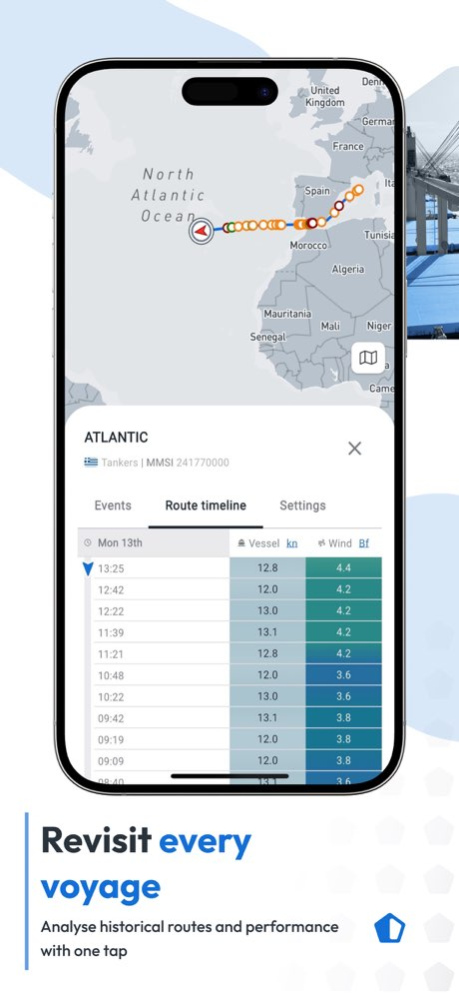
MarineTraffic ist der globale Schiffstracker für Schiffspositionen, Schiffsverfolgung und Bootsnavigation. Verfolgen Sie Frachter, Containerschiffe, Tanker, Fähren, Kreuzfahrtschiffe, Fischerboote und Yachten mit Live-AIS, Hafeninformationen und Wetterdaten.
SCHIFFSTRACKER FÜR MARITIMEN TRANSPORT UND HAFENLOGISTIK
Mit dem Schiffstracker verfolgen Sie täglich mehr als 350.000 Schiffe auf einer interaktiven Weltkarte. Der Schiffstracker zeigt Schiffspositionen, Geschwindigkeit, Kurs, Ziel und ETA. Er unterstützt Reedereien, Flottenmanager, Hafenbehörden, Terminals, maritime Dienstleister und alle, die Seeverkehr und Frachttransport beobachten.
Aktuelle Schiffspositionen schaffen Transparenz über Handelsschiffe, Seefracht und internationale Schifffahrtsrouten. Nutzen Sie Schiffspositionen, um Ankünfte, Abfahrten, Verspätungen und Aktivitäten in mehr als 21.000 Häfen, Marinas und Terminals zu verfolgen.
WELTWEITE SCHIFFSVERFOLGUNG MIT AIS
MarineTraffic bietet Schiffsverfolgung über ein globales AIS-Netzwerk an Land, auf See und im Weltraum. Die Schiffsverfolgung hilft bei Flottenüberwachung, Frachttransport, Hafenlogistik und maritimen Betriebsabläufen. Verfolgen Sie Reiseverläufe, animierte Routen und historische Schiffspositionen.
Für Reedereien, Lieferanten und Logistikteams bietet die Schiffsverfolgung Einblicke in Seefracht, Hafenankünfte, Hafenbelegung und mögliche Verzögerungen. Mit der Schiffsverfolgung lassen sich Flottenbewegungen, maritime Transporte und Lieferketten besser verstehen.
BOOTSNAVIGATION, ROUTEN UND WETTER
Nutzen Sie Bootsnavigation mit Voyage Planner, Seekarten, Winddaten und 48-Stunden-Wettervorhersagen. Die Bootsnavigation unterstützt Küstenfahrten, private Törns und professionelle Seereisen. Kombinieren Sie Bootsnavigation mit Schiffspositionen und Hafeninformationen, um Routen übersichtlich zu planen. Die Bootsnavigation verbindet Route, Wetter und Live-AIS in einer App.
SCHIFFE MIT AUGMENTED REALITY ERKENNEN
Richten Sie Ihr Smartphone auf den Horizont. MarineTraffic identifiziert Schiffe in Ihrer Umgebung und zeigt Live-AIS-Daten in der Kameraansicht. So wird Ihr Gerät zum Schiffstracker mit Schiffspositionen, Name, Flagge, Entfernung, Geschwindigkeit und Ziel.
MIT MARINETRAFFIC KÖNNEN SIE:
• Schiffe mit dem Schiffstracker live verfolgen
• Schiffspositionen und AIS-Daten anzeigen
• Schiffsverfolgung für Flotten, Häfen und Seefracht nutzen
• Bootsnavigation, Seekarten, Wind und Wetter prüfen
• Frachter, Tanker, Fähren und Containerschiffe suchen
• Hafenankünfte, Abfahrten und ETA überwachen
• Schiffsalarme einrichten
• Schiffe per Augmented Reality identifizieren
• Millionen maritime Fotos entdecken
MOBILE PRO
Mobile Pro erweitert die Schiffsverfolgung mit Satellite AIS, Flottenfunktionen und Wetterdaten. Satellite AIS liefert Schiffspositionen auch außerhalb der Küstenabdeckung. Der erweiterte Schiffstracker unterstützt internationale Schifffahrt, maritime Logistik, Seefracht und Bootsnavigation.
MarineTraffic verbindet Schiffstracker, Schiffspositionen, Schiffsverfolgung und Bootsnavigation mit Daten für maritimen Transport, Hafenlogistik, Flottenmanagement und weltweite Schifffahrt.
Laden Sie MarineTraffic herunter: der Schiffstracker für aktuelle Schiffspositionen, zuverlässige Schiffsverfolgung und praktische Bootsnavigation.
Der Schiffstracker verbindet professionelle Schiffsverfolgung mit praktischer Bootsnavigation. Nutzen Sie den Schiffstracker für mehr maritime Transparenz.
So sind Schiffstracker, Schiffspositionen, Schiffsverfolgung und Bootsnavigation jederzeit griffbereit.
Über MarineTraffic: Bootsnavigation
Das Unternehmen, das MarineTraffic: Bootsnavigation entwickelt, ist MarineTraffic Applications LTD. Die neueste vom Entwickler veröffentlichte Version ist 5.9.1.
Um MarineTraffic: Bootsnavigation auf Ihrem iOS-Gerät zu installieren, klicken Sie einfach auf die grüne Schaltfläche Weiter zur App oben, um den Installationsvorgang zu starten. Die App ist seit 2026-10-28 auf unserer Website gelistet und wurde 0 Mal heruntergeladen. Wir haben bereits geprüft, ob der Download-Link sicher ist; zu Ihrem eigenen Schutz empfehlen wir jedoch, die heruntergeladene App mit Ihrem Antivirusprogramm zu scannen. Ihr Antivirusprogramm kann MarineTraffic: Bootsnavigation als Malware erkennen, wenn der Download-Link defekt ist.
So installieren Sie MarineTraffic: Bootsnavigation auf Ihrem iOS-Gerät:
- Klicken Sie auf unserer Website auf die Schaltfläche Weiter zur App. Dadurch werden Sie zum App Store weitergeleitet.
- Sobald MarineTraffic: Bootsnavigation im iTunes-Eintrag Ihres iOS-Geräts angezeigt wird, können Sie den Download und die Installation starten. Tippen Sie rechts neben der App auf die Schaltfläche LADEN, um den Download zu starten.
- Wenn Sie nicht in der iOS App Store App angemeldet sind, werden Sie nach Ihrer Apple-ID und/oder Ihrem Passwort gefragt.
- Nachdem MarineTraffic: Bootsnavigation heruntergeladen wurde, sehen Sie rechts einen INSTALLIEREN-Button. Tippen Sie darauf, um die eigentliche Installation der iOS-App zu starten.
- Sobald die Installation abgeschlossen ist, können Sie auf die Schaltfläche ÖFFNEN tippen, um sie zu starten. Das Symbol wird außerdem zum Startbildschirm Ihres Geräts hinzugefügt.
Programmdetails
Systemanforderungen
Download-Informationen
Preisgestaltung
Versionsgeschichte
Version 5.9.1
veröffentlicht am 2026-10-28
Route du Rhum 2026 live verfolgen
Start am 1. November in Saint-Malo. Tippen Sie auf der Karte auf „Rhum Race“ für Flotte, Skipper, Boote und Live-Positionen.
Einfacherer Reiseplaner
• Etappen per Karte, Schiff, Hafen oder Standort festlegen
• Routenprognose beim Antippen oder Suchen eines Schiffs
• „ETA zu meinem Standort“ wählt den nächsten Hafen vor
Fehlerbehebungen und Stabilität
• Schiffe verschwinden nicht mehr bei gewählter Flotte
• Wind und Hafenanläufe jetzt unter der Schiffsposition
Version 5.8.8
veröffentlicht am 2026-10-14
Version History Minor fixes and improvements 5.8.8 9h ago - Authentication improvements: fewer unexpected logouts, less friction when accessing Mobile Pro Plan and a smoother sign-in experience.
- Vessel details now show reported AIS destination and reported ETA (Mobile Pro Plan users can see the crew's entered information). 5.8.7 Sep 26 Minor fixes and improvements. 5.8.5 Sep 11 Minor fixes and improvements 5.8.4 Sep 1 Minor fixes and improvements. 5.8.3 Aug 20 Minor fixes and improvements 5.8.1 Aug 17 New features:
- Route Forecast (Mobile Pro) : See where a vessel is heading and what weather it will meet on the way. Scrub the timeline to follow the route point by point with wind each step.
- Prediction vectors (Mobile Pro) : Now cover the next 30 minutes for every vessel.
- When zooming, a new scale bar shows distances in both nautical miles and kilometres.
- Vessel length and width are now visible without a subscription.
- A Voyage Planner user guide is now available at the top of the page.
- Port call lists now show country flags.
Fixes:
- Fixed an issue where, sometimes, a vessel's position could be out of date after the map refreshed.
- Fixed an issue where vessels that don't report their size could be drawn at the wrong scale on the map.
- Small UI improvements in My Fleets and Voyage Planner.
- On Android, fixed an issue where some external web links could fail to open. 5.8.0 Aug 3 Fixes
- Fixed an issue where Android user location was incorrect on app opening
- Improved readability of wind direction on nautical maps
- Fixed logout issue - sessions now last longer, reducing unexpected automatic logouts
Improvements
- Added a new setting to choose your preferred distance unit (nm, km, or miles)
- Improved loading experience in the Voyage Planner
- Refreshed Augmented Reality map overlay for improved accuracy 5.7.2 Jul 16 Voyage Planner enhancements
Map pinpoint selection : tap anywhere on the map to set a point, and use it to measure distances directly.
Multi-leg voyages : plan trips with multiple stops in a single voyage, instead of point-to-point only.
New timezone setting
You can now choose how times are displayed across the app: UTC, Local time, or Device time. Find it in Units settings.
Wind detail bug fix
Fixed an issue affecting the accuracy of wind detail information. 5.7.1 Jul 6 Minor fix and improvements 5.7.0 Jul 3 - Multiple bug fixes and small improvements 5.6.0 May 28 - Smoother, more harmonized navigation across the app
- Wind details added to port and ship sheets
- Vessel tracks now colored by speed
- Multiple bug fixes and small improvements 5.4.1 May 20 - Smoother, more harmonized navigation across the app
- Wind details added to port and ship sheets
- Vessel tracks now colored by speed
- Multiple bug fixes and small improvements 5.4.0 May 12 Plan your voyages directly from the app! The full Voyage Planner is now available : calculate routes, distances, and ETAs on the go.
Improvements & Bug fixes
- Smoother zoom when tapping on a vessel
- Ship names displayed closer to their icon
- Larger map refresh button for low-connectivity areas
- Port calls fully aligned with the web app
- Fixed vessels not appearing at certain zoom levels
- Fixed Class B vessel characteristics showing errors 5.3.1 Apr 24 Plan your voyages directly from the app! The full Voyage Planner is now available : calculate routes, distances, and ETAs on the go.
Improvements & Bug fixes
- Smoother zoom when tapping on a vessel
- Ship names displayed closer to their icon
- Larger map refresh button for low-connectivity areas
- Port calls fully aligned with the web app
- Fixed vessels not appearing at certain zoom levels
- Fixed Class B vessel characteristics showing errors 5.3.0 Apr 24 Bug Fixes
• Text display issue (formatting) - Some users with a large device text size were experiencing hidden/cut-off text in the app.
→ The device text size setting will no longer affect the app. All users will now see all text correctly regardless of their device font size.
• Filtered ships reappearing - Ships that were filtered out were incorrectly reappearing when opening a detail page. This edge case will be fixed in next version
• Special characters in ship names - Ships with special characters (e.g. Mike O'Leary) can now be searched and found correctly in the mobile app.
New Feature
• Coordinate format in unit settings - Users will be able to update coordinate formats directly in the units bottom sheet, choosing between DD, DDM, or DMS 5.2.1 Apr 15 Bug fixes and map improvements. 5.2.0 Apr 8 Welcome to the new and improved MarineTraffic
You spoke, we listened. Based on years of feedback, MarineTraffic has been updated to deliver a faster, clearer, and more dependable way to monitor marine traffic and use a powerful vessel tracker for ships worldwide.
If you’ve used MarineTraffic before, you’ll feel at home straight away. The main features remain familiar, now supported by clearer maps, smoother interactions, and a more robust foundation built for long-term use. 5.1.10 Mar 25 Welcome to the new and improved MarineTraffic
You spoke, we listened. Based on years of feedback, MarineTraffic has been updated to deliver a faster, clearer, and more dependable way to monitor marine traffic and use a powerful vessel tracker for ships worldwide.
If you’ve used MarineTraffic before, you’ll feel at home straight away. The main features remain familiar, now supported by clearer maps, smoother interactions, and a more robust foundation built for long-term use. 5.1.9 Mar 20 Welcome to the new and improved MarineTraffic You spoke, we listened. Based on years of feedback, MarineTraffic has been updated to deliver a faster, clearer, and more dependable way to monitor marine traffic and use a powerful vessel tracker for ships worldwide. If you’ve used MarineTraffic before, you’ll feel at home straight away. The main features remain familiar, now supported by clearer maps, smoother interactions, and a more robust foundation built for long-term use. 5.1.8 Mar 17 A unified MarineTraffic experience
The new MarineTraffic brings core tools together into one unified mobile app experience. The new app focuses on clarity, reliability, and ease of use, improving performance while keeping the experience familiar.
Maps load faster, interactions feel smoother, and information is presented more clearly, supporting both everyday use and professional maritime workflows.
What’s improved in MarineTraffic:
Faster performance across maps and weather views
Clearer visuals and smoother interactions throughout the app
Improved platform stability and reliability
Unlock more with the Mobile Pro Plan
The Mobile Pro Plan brings advanced capabilities together for users who need deeper visibility and extended coverage.
With Mobile Pro, you can:
Track vessels beyond coastal coverage using Satellite AIS, including activity in open oceans
Access advanced fleet monitoring tools for wider oversight
Follow vessels with extended historical data and deeper insights
Gain access to additional maritime data layers for professional use
Mobile Pro expands your vessel tracking capabilities when standard AIS coverage is not enough.
Mobile Pro is designed for users who need a broader, more complete view of global vessel movement. 5.1.5 Mar 11 - Fixes issue with Augmented Reality
- Other fixes and improvements 4.2.6 Jan 16 - Fixes issue with iPhone 17 Pro Max
- Other fixes and improvements 4.1.93 12/08/2025 - Fixed issue with advanced weather maps
- Other fixes and improvements 4.1.86 10/18/2025 - Support for iPhone 17 series
- Fixes and improvements 4.1.80 10/06/2025
Version 5.8.7
veröffentlicht am 2026-10-07
Version History - Authentication improvements: fewer unexpected logouts, less friction when accessing Mobile Pro Plan and a smoother sign-in experience.
- Vessel details now show reported AIS destination and reported ETA (Mobile Pro Plan users can see the crew's entered information). 5.8.7 Sep 26 Minor fixes and improvements. 5.8.5 Sep 11 Minor fixes and improvements 5.8.4 Sep 1 Minor fixes and improvements. 5.8.3 Aug 20 Minor fixes and improvements 5.8.1 Aug 17 New features:
- Route Forecast (Mobile Pro) : See where a vessel is heading and what weather it will meet on the way. Scrub the timeline to follow the route point by point with wind each step.
- Prediction vectors (Mobile Pro) : Now cover the next 30 minutes for every vessel.
- When zooming, a new scale bar shows distances in both nautical miles and kilometres.
- Vessel length and width are now visible without a subscription.
- A Voyage Planner user guide is now available at the top of the page.
- Port call lists now show country flags.
Fixes:
- Fixed an issue where, sometimes, a vessel's position could be out of date after the map refreshed.
- Fixed an issue where vessels that don't report their size could be drawn at the wrong scale on the map.
- Small UI improvements in My Fleets and Voyage Planner.
- On Android, fixed an issue where some external web links could fail to open. 5.8.0 Aug 3 Fixes
- Fixed an issue where Android user location was incorrect on app opening
- Improved readability of wind direction on nautical maps
- Fixed logout issue - sessions now last longer, reducing unexpected automatic logouts
Improvements
- Added a new setting to choose your preferred distance unit (nm, km, or miles)
- Improved loading experience in the Voyage Planner
- Refreshed Augmented Reality map overlay for improved accuracy 5.7.2 Jul 16 Voyage Planner enhancements
Map pinpoint selection : tap anywhere on the map to set a point, and use it to measure distances directly.
Multi-leg voyages : plan trips with multiple stops in a single voyage, instead of point-to-point only.
New timezone setting
You can now choose how times are displayed across the app: UTC, Local time, or Device time. Find it in Units settings.
Wind detail bug fix
Fixed an issue affecting the accuracy of wind detail information. 5.7.1 Jul 6 Minor fix and improvements 5.7.0 Jul 3 - Multiple bug fixes and small improvements 5.6.0 May 28 - Smoother, more harmonized navigation across the app
- Wind details added to port and ship sheets
- Vessel tracks now colored by speed
- Multiple bug fixes and small improvements 5.4.1 May 20 - Smoother, more harmonized navigation across the app
- Wind details added to port and ship sheets
- Vessel tracks now colored by speed
- Multiple bug fixes and small improvements 5.4.0 May 12 Plan your voyages directly from the app! The full Voyage Planner is now available : calculate routes, distances, and ETAs on the go.
Improvements & Bug fixes
- Smoother zoom when tapping on a vessel
- Ship names displayed closer to their icon
- Larger map refresh button for low-connectivity areas
- Port calls fully aligned with the web app
- Fixed vessels not appearing at certain zoom levels
- Fixed Class B vessel characteristics showing errors 5.3.1 Apr 24 Plan your voyages directly from the app! The full Voyage Planner is now available : calculate routes, distances, and ETAs on the go.
Improvements & Bug fixes
- Smoother zoom when tapping on a vessel
- Ship names displayed closer to their icon
- Larger map refresh button for low-connectivity areas
- Port calls fully aligned with the web app
- Fixed vessels not appearing at certain zoom levels
- Fixed Class B vessel characteristics showing errors 5.3.0 Apr 24 Bug Fixes
• Text display issue (formatting) - Some users with a large device text size were experiencing hidden/cut-off text in the app.
→ The device text size setting will no longer affect the app. All users will now see all text correctly regardless of their device font size.
• Filtered ships reappearing - Ships that were filtered out were incorrectly reappearing when opening a detail page. This edge case will be fixed in next version
• Special characters in ship names - Ships with special characters (e.g. Mike O'Leary) can now be searched and found correctly in the mobile app.
New Feature
• Coordinate format in unit settings - Users will be able to update coordinate formats directly in the units bottom sheet, choosing between DD, DDM, or DMS 5.2.1 Apr 15 Bug fixes and map improvements. 5.2.0 Apr 8 Welcome to the new and improved MarineTraffic
You spoke, we listened. Based on years of feedback, MarineTraffic has been updated to deliver a faster, clearer, and more dependable way to monitor marine traffic and use a powerful vessel tracker for ships worldwide.
If you’ve used MarineTraffic before, you’ll feel at home straight away. The main features remain familiar, now supported by clearer maps, smoother interactions, and a more robust foundation built for long-term use. 5.1.10 Mar 25 Welcome to the new and improved MarineTraffic
You spoke, we listened. Based on years of feedback, MarineTraffic has been updated to deliver a faster, clearer, and more dependable way to monitor marine traffic and use a powerful vessel tracker for ships worldwide.
If you’ve used MarineTraffic before, you’ll feel at home straight away. The main features remain familiar, now supported by clearer maps, smoother interactions, and a more robust foundation built for long-term use. 5.1.9 Mar 20 Welcome to the new and improved MarineTraffic You spoke, we listened. Based on years of feedback, MarineTraffic has been updated to deliver a faster, clearer, and more dependable way to monitor marine traffic and use a powerful vessel tracker for ships worldwide. If you’ve used MarineTraffic before, you’ll feel at home straight away. The main features remain familiar, now supported by clearer maps, smoother interactions, and a more robust foundation built for long-term use. 5.1.8 Mar 17 A unified MarineTraffic experience
The new MarineTraffic brings core tools together into one unified mobile app experience. The new app focuses on clarity, reliability, and ease of use, improving performance while keeping the experience familiar.
Maps load faster, interactions feel smoother, and information is presented more clearly, supporting both everyday use and professional maritime workflows.
What’s improved in MarineTraffic:
Faster performance across maps and weather views
Clearer visuals and smoother interactions throughout the app
Improved platform stability and reliability
Unlock more with the Mobile Pro Plan
The Mobile Pro Plan brings advanced capabilities together for users who need deeper visibility and extended coverage.
With Mobile Pro, you can:
Track vessels beyond coastal coverage using Satellite AIS, including activity in open oceans
Access advanced fleet monitoring tools for wider oversight
Follow vessels with extended historical data and deeper insights
Gain access to additional maritime data layers for professional use
Mobile Pro expands your vessel tracking capabilities when standard AIS coverage is not enough.
Mobile Pro is designed for users who need a broader, more complete view of global vessel movement. 5.1.5 Mar 11 - Fixes issue with Augmented Reality
- Other fixes and improvements 4.2.6 Jan 16 - Fixes issue with iPhone 17 Pro Max
- Other fixes and improvements 4.1.93 12/08/2025 - Fixed issue with advanced weather maps
- Other fixes and improvements 4.1.86 10/18/2025 - Support for iPhone 17 series
- Fixes and improvements 4.1.80 10/06/2025 - Bug fixes and improvements 4.1.78 08/30/2025
Version 5.8.7
veröffentlicht am 2026-09-26
Version History - Authentication improvements: fewer unexpected logouts, less friction when accessing Mobile Pro Plan and a smoother sign-in experience.
- Vessel details now show reported AIS destination and reported ETA (Mobile Pro Plan users can see the crew's entered information). 5.8.7 2h ago Minor fixes and improvements. 5.8.5 Sep 11 Minor fixes and improvements 5.8.4 Sep 1 Minor fixes and improvements. 5.8.3 Aug 20 Minor fixes and improvements 5.8.1 Aug 17 New features:
- Route Forecast (Mobile Pro) : See where a vessel is heading and what weather it will meet on the way. Scrub the timeline to follow the route point by point with wind each step.
- Prediction vectors (Mobile Pro) : Now cover the next 30 minutes for every vessel.
- When zooming, a new scale bar shows distances in both nautical miles and kilometres.
- Vessel length and width are now visible without a subscription.
- A Voyage Planner user guide is now available at the top of the page.
- Port call lists now show country flags.
Fixes:
- Fixed an issue where, sometimes, a vessel's position could be out of date after the map refreshed.
- Fixed an issue where vessels that don't report their size could be drawn at the wrong scale on the map.
- Small UI improvements in My Fleets and Voyage Planner.
- On Android, fixed an issue where some external web links could fail to open. 5.8.0 Aug 3 Fixes
- Fixed an issue where Android user location was incorrect on app opening
- Improved readability of wind direction on nautical maps
- Fixed logout issue - sessions now last longer, reducing unexpected automatic logouts
Improvements
- Added a new setting to choose your preferred distance unit (nm, km, or miles)
- Improved loading experience in the Voyage Planner
- Refreshed Augmented Reality map overlay for improved accuracy 5.7.2 Jul 16 Voyage Planner enhancements
Map pinpoint selection : tap anywhere on the map to set a point, and use it to measure distances directly.
Multi-leg voyages : plan trips with multiple stops in a single voyage, instead of point-to-point only.
New timezone setting
You can now choose how times are displayed across the app: UTC, Local time, or Device time. Find it in Units settings.
Wind detail bug fix
Fixed an issue affecting the accuracy of wind detail information. 5.7.1 Jul 6 Minor fix and improvements 5.7.0 Jul 3 - Multiple bug fixes and small improvements 5.6.0 May 28 - Smoother, more harmonized navigation across the app
- Wind details added to port and ship sheets
- Vessel tracks now colored by speed
- Multiple bug fixes and small improvements 5.4.1 May 20 - Smoother, more harmonized navigation across the app
- Wind details added to port and ship sheets
- Vessel tracks now colored by speed
- Multiple bug fixes and small improvements 5.4.0 May 12 Plan your voyages directly from the app! The full Voyage Planner is now available : calculate routes, distances, and ETAs on the go.
Improvements & Bug fixes
- Smoother zoom when tapping on a vessel
- Ship names displayed closer to their icon
- Larger map refresh button for low-connectivity areas
- Port calls fully aligned with the web app
- Fixed vessels not appearing at certain zoom levels
- Fixed Class B vessel characteristics showing errors 5.3.1 Apr 24 Plan your voyages directly from the app! The full Voyage Planner is now available : calculate routes, distances, and ETAs on the go.
Improvements & Bug fixes
- Smoother zoom when tapping on a vessel
- Ship names displayed closer to their icon
- Larger map refresh button for low-connectivity areas
- Port calls fully aligned with the web app
- Fixed vessels not appearing at certain zoom levels
- Fixed Class B vessel characteristics showing errors 5.3.0 Apr 24 Bug Fixes
• Text display issue (formatting) - Some users with a large device text size were experiencing hidden/cut-off text in the app.
→ The device text size setting will no longer affect the app. All users will now see all text correctly regardless of their device font size.
• Filtered ships reappearing - Ships that were filtered out were incorrectly reappearing when opening a detail page. This edge case will be fixed in next version
• Special characters in ship names - Ships with special characters (e.g. Mike O'Leary) can now be searched and found correctly in the mobile app.
New Feature
• Coordinate format in unit settings - Users will be able to update coordinate formats directly in the units bottom sheet, choosing between DD, DDM, or DMS 5.2.1 Apr 15 Bug fixes and map improvements. 5.2.0 Apr 8 Welcome to the new and improved MarineTraffic
You spoke, we listened. Based on years of feedback, MarineTraffic has been updated to deliver a faster, clearer, and more dependable way to monitor marine traffic and use a powerful vessel tracker for ships worldwide.
If you’ve used MarineTraffic before, you’ll feel at home straight away. The main features remain familiar, now supported by clearer maps, smoother interactions, and a more robust foundation built for long-term use. 5.1.10 Mar 25 Welcome to the new and improved MarineTraffic
You spoke, we listened. Based on years of feedback, MarineTraffic has been updated to deliver a faster, clearer, and more dependable way to monitor marine traffic and use a powerful vessel tracker for ships worldwide.
If you’ve used MarineTraffic before, you’ll feel at home straight away. The main features remain familiar, now supported by clearer maps, smoother interactions, and a more robust foundation built for long-term use. 5.1.9 Mar 20 Welcome to the new and improved MarineTraffic You spoke, we listened. Based on years of feedback, MarineTraffic has been updated to deliver a faster, clearer, and more dependable way to monitor marine traffic and use a powerful vessel tracker for ships worldwide. If you’ve used MarineTraffic before, you’ll feel at home straight away. The main features remain familiar, now supported by clearer maps, smoother interactions, and a more robust foundation built for long-term use. 5.1.8 Mar 17 A unified MarineTraffic experience
The new MarineTraffic brings core tools together into one unified mobile app experience. The new app focuses on clarity, reliability, and ease of use, improving performance while keeping the experience familiar.
Maps load faster, interactions feel smoother, and information is presented more clearly, supporting both everyday use and professional maritime workflows.
What’s improved in MarineTraffic:
Faster performance across maps and weather views
Clearer visuals and smoother interactions throughout the app
Improved platform stability and reliability
Unlock more with the Mobile Pro Plan
The Mobile Pro Plan brings advanced capabilities together for users who need deeper visibility and extended coverage.
With Mobile Pro, you can:
Track vessels beyond coastal coverage using Satellite AIS, including activity in open oceans
Access advanced fleet monitoring tools for wider oversight
Follow vessels with extended historical data and deeper insights
Gain access to additional maritime data layers for professional use
Mobile Pro expands your vessel tracking capabilities when standard AIS coverage is not enough.
Mobile Pro is designed for users who need a broader, more complete view of global vessel movement. 5.1.5 Mar 11 - Fixes issue with Augmented Reality
- Other fixes and improvements 4.2.6 Jan 16 - Fixes issue with iPhone 17 Pro Max
- Other fixes and improvements 4.1.93 12/08/2025 - Fixed issue with advanced weather maps
- Other fixes and improvements 4.1.86 10/18/2025 - Support for iPhone 17 series
- Fixes and improvements 4.1.80 10/06/2025 - Bug fixes and improvements 4.1.78 08/30/2025
Version 5.8.5
veröffentlicht am 2026-09-19
Version History Minor fixes and improvements. 5.8.5 Sep 11 Minor fixes and improvements 5.8.4 Sep 1 Minor fixes and improvements. 5.8.3 Aug 20 Minor fixes and improvements 5.8.1 Aug 17 New features:
- Route Forecast (Mobile Pro) : See where a vessel is heading and what weather it will meet on the way. Scrub the timeline to follow the route point by point with wind each step.
- Prediction vectors (Mobile Pro) : Now cover the next 30 minutes for every vessel.
- When zooming, a new scale bar shows distances in both nautical miles and kilometres.
- Vessel length and width are now visible without a subscription.
- A Voyage Planner user guide is now available at the top of the page.
- Port call lists now show country flags.
Fixes:
- Fixed an issue where, sometimes, a vessel's position could be out of date after the map refreshed.
- Fixed an issue where vessels that don't report their size could be drawn at the wrong scale on the map.
- Small UI improvements in My Fleets and Voyage Planner.
- On Android, fixed an issue where some external web links could fail to open. 5.8.0 Aug 3 Fixes
- Fixed an issue where Android user location was incorrect on app opening
- Improved readability of wind direction on nautical maps
- Fixed logout issue - sessions now last longer, reducing unexpected automatic logouts
Improvements
- Added a new setting to choose your preferred distance unit (nm, km, or miles)
- Improved loading experience in the Voyage Planner
- Refreshed Augmented Reality map overlay for improved accuracy 5.7.2 Jul 16 Voyage Planner enhancements
Map pinpoint selection : tap anywhere on the map to set a point, and use it to measure distances directly.
Multi-leg voyages : plan trips with multiple stops in a single voyage, instead of point-to-point only.
New timezone setting
You can now choose how times are displayed across the app: UTC, Local time, or Device time. Find it in Units settings.
Wind detail bug fix
Fixed an issue affecting the accuracy of wind detail information. 5.7.1 Jul 6 Minor fix and improvements 5.7.0 Jul 3 - Multiple bug fixes and small improvements 5.6.0 May 28 - Smoother, more harmonized navigation across the app
- Wind details added to port and ship sheets
- Vessel tracks now colored by speed
- Multiple bug fixes and small improvements 5.4.1 May 20 - Smoother, more harmonized navigation across the app
- Wind details added to port and ship sheets
- Vessel tracks now colored by speed
- Multiple bug fixes and small improvements 5.4.0 May 12 Plan your voyages directly from the app! The full Voyage Planner is now available : calculate routes, distances, and ETAs on the go.
Improvements & Bug fixes
- Smoother zoom when tapping on a vessel
- Ship names displayed closer to their icon
- Larger map refresh button for low-connectivity areas
- Port calls fully aligned with the web app
- Fixed vessels not appearing at certain zoom levels
- Fixed Class B vessel characteristics showing errors 5.3.1 Apr 24 Plan your voyages directly from the app! The full Voyage Planner is now available : calculate routes, distances, and ETAs on the go.
Improvements & Bug fixes
- Smoother zoom when tapping on a vessel
- Ship names displayed closer to their icon
- Larger map refresh button for low-connectivity areas
- Port calls fully aligned with the web app
- Fixed vessels not appearing at certain zoom levels
- Fixed Class B vessel characteristics showing errors 5.3.0 Apr 24 Bug Fixes
• Text display issue (formatting) - Some users with a large device text size were experiencing hidden/cut-off text in the app.
→ The device text size setting will no longer affect the app. All users will now see all text correctly regardless of their device font size.
• Filtered ships reappearing - Ships that were filtered out were incorrectly reappearing when opening a detail page. This edge case will be fixed in next version
• Special characters in ship names - Ships with special characters (e.g. Mike O'Leary) can now be searched and found correctly in the mobile app.
New Feature
• Coordinate format in unit settings - Users will be able to update coordinate formats directly in the units bottom sheet, choosing between DD, DDM, or DMS 5.2.1 Apr 15 Bug fixes and map improvements. 5.2.0 Apr 8 Welcome to the new and improved MarineTraffic
You spoke, we listened. Based on years of feedback, MarineTraffic has been updated to deliver a faster, clearer, and more dependable way to monitor marine traffic and use a powerful vessel tracker for ships worldwide.
If you’ve used MarineTraffic before, you’ll feel at home straight away. The main features remain familiar, now supported by clearer maps, smoother interactions, and a more robust foundation built for long-term use. 5.1.10 Mar 25 Welcome to the new and improved MarineTraffic
You spoke, we listened. Based on years of feedback, MarineTraffic has been updated to deliver a faster, clearer, and more dependable way to monitor marine traffic and use a powerful vessel tracker for ships worldwide.
If you’ve used MarineTraffic before, you’ll feel at home straight away. The main features remain familiar, now supported by clearer maps, smoother interactions, and a more robust foundation built for long-term use. 5.1.9 Mar 20 Welcome to the new and improved MarineTraffic You spoke, we listened. Based on years of feedback, MarineTraffic has been updated to deliver a faster, clearer, and more dependable way to monitor marine traffic and use a powerful vessel tracker for ships worldwide. If you’ve used MarineTraffic before, you’ll feel at home straight away. The main features remain familiar, now supported by clearer maps, smoother interactions, and a more robust foundation built for long-term use. 5.1.8 Mar 17 A unified MarineTraffic experience
The new MarineTraffic brings core tools together into one unified mobile app experience. The new app focuses on clarity, reliability, and ease of use, improving performance while keeping the experience familiar.
Maps load faster, interactions feel smoother, and information is presented more clearly, supporting both everyday use and professional maritime workflows.
What’s improved in MarineTraffic:
Faster performance across maps and weather views
Clearer visuals and smoother interactions throughout the app
Improved platform stability and reliability
Unlock more with the Mobile Pro Plan
The Mobile Pro Plan brings advanced capabilities together for users who need deeper visibility and extended coverage.
With Mobile Pro, you can:
Track vessels beyond coastal coverage using Satellite AIS, including activity in open oceans
Access advanced fleet monitoring tools for wider oversight
Follow vessels with extended historical data and deeper insights
Gain access to additional maritime data layers for professional use
Mobile Pro expands your vessel tracking capabilities when standard AIS coverage is not enough.
Mobile Pro is designed for users who need a broader, more complete view of global vessel movement. 5.1.5 Mar 11 - Fixes issue with Augmented Reality
- Other fixes and improvements 4.2.6 Jan 16 - Fixes issue with iPhone 17 Pro Max
- Other fixes and improvements 4.1.93 12/08/2025 - Fixed issue with advanced weather maps
- Other fixes and improvements 4.1.86 10/18/2025 - Support for iPhone 17 series
- Fixes and improvements 4.1.80 10/06/2025 - Bug fixes and improvements 4.1.78 08/30/2025 - Map layers update
- Support for iPhone 16e
- Bug fixes and improvements 4.1.62 06/26/2025
Version 5.8.5
veröffentlicht am 2026-09-12
Version History Minor fixes and improvements. 5.8.5 21h ago Minor fixes and improvements 5.8.4 Sep 1 Minor fixes and improvements. 5.8.3 Aug 20 Minor fixes and improvements 5.8.1 Aug 17 New features:
- Route Forecast (Mobile Pro) : See where a vessel is heading and what weather it will meet on the way. Scrub the timeline to follow the route point by point with wind each step.
- Prediction vectors (Mobile Pro) : Now cover the next 30 minutes for every vessel.
- When zooming, a new scale bar shows distances in both nautical miles and kilometres.
- Vessel length and width are now visible without a subscription.
- A Voyage Planner user guide is now available at the top of the page.
- Port call lists now show country flags.
Fixes:
- Fixed an issue where, sometimes, a vessel's position could be out of date after the map refreshed.
- Fixed an issue where vessels that don't report their size could be drawn at the wrong scale on the map.
- Small UI improvements in My Fleets and Voyage Planner.
- On Android, fixed an issue where some external web links could fail to open. 5.8.0 Aug 3 Fixes
- Fixed an issue where Android user location was incorrect on app opening
- Improved readability of wind direction on nautical maps
- Fixed logout issue - sessions now last longer, reducing unexpected automatic logouts
Improvements
- Added a new setting to choose your preferred distance unit (nm, km, or miles)
- Improved loading experience in the Voyage Planner
- Refreshed Augmented Reality map overlay for improved accuracy 5.7.2 Jul 16 Voyage Planner enhancements
Map pinpoint selection : tap anywhere on the map to set a point, and use it to measure distances directly.
Multi-leg voyages : plan trips with multiple stops in a single voyage, instead of point-to-point only.
New timezone setting
You can now choose how times are displayed across the app: UTC, Local time, or Device time. Find it in Units settings.
Wind detail bug fix
Fixed an issue affecting the accuracy of wind detail information. 5.7.1 Jul 6 Minor fix and improvements 5.7.0 Jul 3 - Multiple bug fixes and small improvements 5.6.0 May 28 - Smoother, more harmonized navigation across the app
- Wind details added to port and ship sheets
- Vessel tracks now colored by speed
- Multiple bug fixes and small improvements 5.4.1 May 20 - Smoother, more harmonized navigation across the app
- Wind details added to port and ship sheets
- Vessel tracks now colored by speed
- Multiple bug fixes and small improvements 5.4.0 May 12 Plan your voyages directly from the app! The full Voyage Planner is now available : calculate routes, distances, and ETAs on the go.
Improvements & Bug fixes
- Smoother zoom when tapping on a vessel
- Ship names displayed closer to their icon
- Larger map refresh button for low-connectivity areas
- Port calls fully aligned with the web app
- Fixed vessels not appearing at certain zoom levels
- Fixed Class B vessel characteristics showing errors 5.3.1 Apr 24 Plan your voyages directly from the app! The full Voyage Planner is now available : calculate routes, distances, and ETAs on the go.
Improvements & Bug fixes
- Smoother zoom when tapping on a vessel
- Ship names displayed closer to their icon
- Larger map refresh button for low-connectivity areas
- Port calls fully aligned with the web app
- Fixed vessels not appearing at certain zoom levels
- Fixed Class B vessel characteristics showing errors 5.3.0 Apr 24 Bug Fixes
• Text display issue (formatting) - Some users with a large device text size were experiencing hidden/cut-off text in the app.
→ The device text size setting will no longer affect the app. All users will now see all text correctly regardless of their device font size.
• Filtered ships reappearing - Ships that were filtered out were incorrectly reappearing when opening a detail page. This edge case will be fixed in next version
• Special characters in ship names - Ships with special characters (e.g. Mike O'Leary) can now be searched and found correctly in the mobile app.
New Feature
• Coordinate format in unit settings - Users will be able to update coordinate formats directly in the units bottom sheet, choosing between DD, DDM, or DMS 5.2.1 Apr 15 Bug fixes and map improvements. 5.2.0 Apr 8 Welcome to the new and improved MarineTraffic
You spoke, we listened. Based on years of feedback, MarineTraffic has been updated to deliver a faster, clearer, and more dependable way to monitor marine traffic and use a powerful vessel tracker for ships worldwide.
If you’ve used MarineTraffic before, you’ll feel at home straight away. The main features remain familiar, now supported by clearer maps, smoother interactions, and a more robust foundation built for long-term use. 5.1.10 Mar 25 Welcome to the new and improved MarineTraffic
You spoke, we listened. Based on years of feedback, MarineTraffic has been updated to deliver a faster, clearer, and more dependable way to monitor marine traffic and use a powerful vessel tracker for ships worldwide.
If you’ve used MarineTraffic before, you’ll feel at home straight away. The main features remain familiar, now supported by clearer maps, smoother interactions, and a more robust foundation built for long-term use. 5.1.9 Mar 20 Welcome to the new and improved MarineTraffic You spoke, we listened. Based on years of feedback, MarineTraffic has been updated to deliver a faster, clearer, and more dependable way to monitor marine traffic and use a powerful vessel tracker for ships worldwide. If you’ve used MarineTraffic before, you’ll feel at home straight away. The main features remain familiar, now supported by clearer maps, smoother interactions, and a more robust foundation built for long-term use. 5.1.8 Mar 17 A unified MarineTraffic experience
The new MarineTraffic brings core tools together into one unified mobile app experience. The new app focuses on clarity, reliability, and ease of use, improving performance while keeping the experience familiar.
Maps load faster, interactions feel smoother, and information is presented more clearly, supporting both everyday use and professional maritime workflows.
What’s improved in MarineTraffic:
Faster performance across maps and weather views
Clearer visuals and smoother interactions throughout the app
Improved platform stability and reliability
Unlock more with the Mobile Pro Plan
The Mobile Pro Plan brings advanced capabilities together for users who need deeper visibility and extended coverage.
With Mobile Pro, you can:
Track vessels beyond coastal coverage using Satellite AIS, including activity in open oceans
Access advanced fleet monitoring tools for wider oversight
Follow vessels with extended historical data and deeper insights
Gain access to additional maritime data layers for professional use
Mobile Pro expands your vessel tracking capabilities when standard AIS coverage is not enough.
Mobile Pro is designed for users who need a broader, more complete view of global vessel movement. 5.1.5 Mar 11 - Fixes issue with Augmented Reality
- Other fixes and improvements 4.2.6 Jan 16 - Fixes issue with iPhone 17 Pro Max
- Other fixes and improvements 4.1.93 12/08/2025 - Fixed issue with advanced weather maps
- Other fixes and improvements 4.1.86 10/18/2025 - Support for iPhone 17 series
- Fixes and improvements 4.1.80 10/06/2025 - Bug fixes and improvements 4.1.78 08/30/2025 - Map layers update
- Support for iPhone 16e
- Bug fixes and improvements 4.1.62 06/26/2025
Version 5.8.4
veröffentlicht am 2026-09-04
Version History Minor fixes and improvements 5.8.4 3d ago Minor fixes and improvements. 5.8.3 Aug 20 Minor fixes and improvements 5.8.1 Aug 17 New features:
- Route Forecast (Mobile Pro) : See where a vessel is heading and what weather it will meet on the way. Scrub the timeline to follow the route point by point with wind each step.
- Prediction vectors (Mobile Pro) : Now cover the next 30 minutes for every vessel.
- When zooming, a new scale bar shows distances in both nautical miles and kilometres.
- Vessel length and width are now visible without a subscription.
- A Voyage Planner user guide is now available at the top of the page.
- Port call lists now show country flags.
Fixes:
- Fixed an issue where, sometimes, a vessel's position could be out of date after the map refreshed.
- Fixed an issue where vessels that don't report their size could be drawn at the wrong scale on the map.
- Small UI improvements in My Fleets and Voyage Planner.
- On Android, fixed an issue where some external web links could fail to open. 5.8.0 Aug 3 Fixes
- Fixed an issue where Android user location was incorrect on app opening
- Improved readability of wind direction on nautical maps
- Fixed logout issue - sessions now last longer, reducing unexpected automatic logouts
Improvements
- Added a new setting to choose your preferred distance unit (nm, km, or miles)
- Improved loading experience in the Voyage Planner
- Refreshed Augmented Reality map overlay for improved accuracy 5.7.2 Jul 16 Voyage Planner enhancements
Map pinpoint selection : tap anywhere on the map to set a point, and use it to measure distances directly.
Multi-leg voyages : plan trips with multiple stops in a single voyage, instead of point-to-point only.
New timezone setting
You can now choose how times are displayed across the app: UTC, Local time, or Device time. Find it in Units settings.
Wind detail bug fix
Fixed an issue affecting the accuracy of wind detail information. 5.7.1 Jul 6 Minor fix and improvements 5.7.0 Jul 3 - Multiple bug fixes and small improvements 5.6.0 May 28 - Smoother, more harmonized navigation across the app
- Wind details added to port and ship sheets
- Vessel tracks now colored by speed
- Multiple bug fixes and small improvements 5.4.1 May 20 - Smoother, more harmonized navigation across the app
- Wind details added to port and ship sheets
- Vessel tracks now colored by speed
- Multiple bug fixes and small improvements 5.4.0 May 12 Plan your voyages directly from the app! The full Voyage Planner is now available : calculate routes, distances, and ETAs on the go.
Improvements & Bug fixes
- Smoother zoom when tapping on a vessel
- Ship names displayed closer to their icon
- Larger map refresh button for low-connectivity areas
- Port calls fully aligned with the web app
- Fixed vessels not appearing at certain zoom levels
- Fixed Class B vessel characteristics showing errors 5.3.1 Apr 24 Plan your voyages directly from the app! The full Voyage Planner is now available : calculate routes, distances, and ETAs on the go.
Improvements & Bug fixes
- Smoother zoom when tapping on a vessel
- Ship names displayed closer to their icon
- Larger map refresh button for low-connectivity areas
- Port calls fully aligned with the web app
- Fixed vessels not appearing at certain zoom levels
- Fixed Class B vessel characteristics showing errors 5.3.0 Apr 24 Bug Fixes
• Text display issue (formatting) - Some users with a large device text size were experiencing hidden/cut-off text in the app.
→ The device text size setting will no longer affect the app. All users will now see all text correctly regardless of their device font size.
• Filtered ships reappearing - Ships that were filtered out were incorrectly reappearing when opening a detail page. This edge case will be fixed in next version
• Special characters in ship names - Ships with special characters (e.g. Mike O'Leary) can now be searched and found correctly in the mobile app.
New Feature
• Coordinate format in unit settings - Users will be able to update coordinate formats directly in the units bottom sheet, choosing between DD, DDM, or DMS 5.2.1 Apr 15 Bug fixes and map improvements. 5.2.0 Apr 8 Welcome to the new and improved MarineTraffic
You spoke, we listened. Based on years of feedback, MarineTraffic has been updated to deliver a faster, clearer, and more dependable way to monitor marine traffic and use a powerful vessel tracker for ships worldwide.
If you’ve used MarineTraffic before, you’ll feel at home straight away. The main features remain familiar, now supported by clearer maps, smoother interactions, and a more robust foundation built for long-term use. 5.1.10 Mar 25 Welcome to the new and improved MarineTraffic
You spoke, we listened. Based on years of feedback, MarineTraffic has been updated to deliver a faster, clearer, and more dependable way to monitor marine traffic and use a powerful vessel tracker for ships worldwide.
If you’ve used MarineTraffic before, you’ll feel at home straight away. The main features remain familiar, now supported by clearer maps, smoother interactions, and a more robust foundation built for long-term use. 5.1.9 Mar 20 Welcome to the new and improved MarineTraffic You spoke, we listened. Based on years of feedback, MarineTraffic has been updated to deliver a faster, clearer, and more dependable way to monitor marine traffic and use a powerful vessel tracker for ships worldwide. If you’ve used MarineTraffic before, you’ll feel at home straight away. The main features remain familiar, now supported by clearer maps, smoother interactions, and a more robust foundation built for long-term use. 5.1.8 Mar 17 A unified MarineTraffic experience
The new MarineTraffic brings core tools together into one unified mobile app experience. The new app focuses on clarity, reliability, and ease of use, improving performance while keeping the experience familiar.
Maps load faster, interactions feel smoother, and information is presented more clearly, supporting both everyday use and professional maritime workflows.
What’s improved in MarineTraffic:
Faster performance across maps and weather views
Clearer visuals and smoother interactions throughout the app
Improved platform stability and reliability
Unlock more with the Mobile Pro Plan
The Mobile Pro Plan brings advanced capabilities together for users who need deeper visibility and extended coverage.
With Mobile Pro, you can:
Track vessels beyond coastal coverage using Satellite AIS, including activity in open oceans
Access advanced fleet monitoring tools for wider oversight
Follow vessels with extended historical data and deeper insights
Gain access to additional maritime data layers for professional use
Mobile Pro expands your vessel tracking capabilities when standard AIS coverage is not enough.
Mobile Pro is designed for users who need a broader, more complete view of global vessel movement. 5.1.5 Mar 11 - Fixes issue with Augmented Reality
- Other fixes and improvements 4.2.6 Jan 16 - Fixes issue with iPhone 17 Pro Max
- Other fixes and improvements 4.1.93 12/08/2025 - Fixed issue with advanced weather maps
- Other fixes and improvements 4.1.86 10/18/2025 - Support for iPhone 17 series
- Fixes and improvements 4.1.80 10/06/2025 - Bug fixes and improvements 4.1.78 08/30/2025 - Map layers update
- Support for iPhone 16e
- Bug fixes and improvements 4.1.62 06/26/2025 - Fixes issue with lighthouses
- Fixes issue with photo rating
- Density Maps updates 4.1.42 03/13/2025
Version 5.8.3
veröffentlicht am 2026-08-22
Version History Minor fixes and improvements. 5.8.3 2d ago Minor fixes and improvements 5.8.1 5d ago New features:
- Route Forecast (Mobile Pro) : See where a vessel is heading and what weather it will meet on the way. Scrub the timeline to follow the route point by point with wind each step.
- Prediction vectors (Mobile Pro) : Now cover the next 30 minutes for every vessel.
- When zooming, a new scale bar shows distances in both nautical miles and kilometres.
- Vessel length and width are now visible without a subscription.
- A Voyage Planner user guide is now available at the top of the page.
- Port call lists now show country flags.
Fixes:
- Fixed an issue where, sometimes, a vessel's position could be out of date after the map refreshed.
- Fixed an issue where vessels that don't report their size could be drawn at the wrong scale on the map.
- Small UI improvements in My Fleets and Voyage Planner.
- On Android, fixed an issue where some external web links could fail to open. 5.8.0 Aug 3 Fixes
- Fixed an issue where Android user location was incorrect on app opening
- Improved readability of wind direction on nautical maps
- Fixed logout issue - sessions now last longer, reducing unexpected automatic logouts
Improvements
- Added a new setting to choose your preferred distance unit (nm, km, or miles)
- Improved loading experience in the Voyage Planner
- Refreshed Augmented Reality map overlay for improved accuracy 5.7.2 Jul 16 Voyage Planner enhancements
Map pinpoint selection : tap anywhere on the map to set a point, and use it to measure distances directly.
Multi-leg voyages : plan trips with multiple stops in a single voyage, instead of point-to-point only.
New timezone setting
You can now choose how times are displayed across the app: UTC, Local time, or Device time. Find it in Units settings.
Wind detail bug fix
Fixed an issue affecting the accuracy of wind detail information. 5.7.1 Jul 6 Minor fix and improvements 5.7.0 Jul 3 - Multiple bug fixes and small improvements 5.6.0 May 28 - Smoother, more harmonized navigation across the app
- Wind details added to port and ship sheets
- Vessel tracks now colored by speed
- Multiple bug fixes and small improvements 5.4.1 May 20 - Smoother, more harmonized navigation across the app
- Wind details added to port and ship sheets
- Vessel tracks now colored by speed
- Multiple bug fixes and small improvements 5.4.0 May 12 Plan your voyages directly from the app! The full Voyage Planner is now available : calculate routes, distances, and ETAs on the go.
Improvements & Bug fixes
- Smoother zoom when tapping on a vessel
- Ship names displayed closer to their icon
- Larger map refresh button for low-connectivity areas
- Port calls fully aligned with the web app
- Fixed vessels not appearing at certain zoom levels
- Fixed Class B vessel characteristics showing errors 5.3.1 Apr 24 Plan your voyages directly from the app! The full Voyage Planner is now available : calculate routes, distances, and ETAs on the go.
Improvements & Bug fixes
- Smoother zoom when tapping on a vessel
- Ship names displayed closer to their icon
- Larger map refresh button for low-connectivity areas
- Port calls fully aligned with the web app
- Fixed vessels not appearing at certain zoom levels
- Fixed Class B vessel characteristics showing errors 5.3.0 Apr 24 Bug Fixes
• Text display issue (formatting) - Some users with a large device text size were experiencing hidden/cut-off text in the app.
→ The device text size setting will no longer affect the app. All users will now see all text correctly regardless of their device font size.
• Filtered ships reappearing - Ships that were filtered out were incorrectly reappearing when opening a detail page. This edge case will be fixed in next version
• Special characters in ship names - Ships with special characters (e.g. Mike O'Leary) can now be searched and found correctly in the mobile app.
New Feature
• Coordinate format in unit settings - Users will be able to update coordinate formats directly in the units bottom sheet, choosing between DD, DDM, or DMS 5.2.1 Apr 15 Bug fixes and map improvements. 5.2.0 Apr 8 Welcome to the new and improved MarineTraffic
You spoke, we listened. Based on years of feedback, MarineTraffic has been updated to deliver a faster, clearer, and more dependable way to monitor marine traffic and use a powerful vessel tracker for ships worldwide.
If you’ve used MarineTraffic before, you’ll feel at home straight away. The main features remain familiar, now supported by clearer maps, smoother interactions, and a more robust foundation built for long-term use. 5.1.10 Mar 25 Welcome to the new and improved MarineTraffic
You spoke, we listened. Based on years of feedback, MarineTraffic has been updated to deliver a faster, clearer, and more dependable way to monitor marine traffic and use a powerful vessel tracker for ships worldwide.
If you’ve used MarineTraffic before, you’ll feel at home straight away. The main features remain familiar, now supported by clearer maps, smoother interactions, and a more robust foundation built for long-term use. 5.1.9 Mar 20 Welcome to the new and improved MarineTraffic You spoke, we listened. Based on years of feedback, MarineTraffic has been updated to deliver a faster, clearer, and more dependable way to monitor marine traffic and use a powerful vessel tracker for ships worldwide. If you’ve used MarineTraffic before, you’ll feel at home straight away. The main features remain familiar, now supported by clearer maps, smoother interactions, and a more robust foundation built for long-term use. 5.1.8 Mar 17 A unified MarineTraffic experience
The new MarineTraffic brings core tools together into one unified mobile app experience. The new app focuses on clarity, reliability, and ease of use, improving performance while keeping the experience familiar.
Maps load faster, interactions feel smoother, and information is presented more clearly, supporting both everyday use and professional maritime workflows.
What’s improved in MarineTraffic:
Faster performance across maps and weather views
Clearer visuals and smoother interactions throughout the app
Improved platform stability and reliability
Unlock more with the Mobile Pro Plan
The Mobile Pro Plan brings advanced capabilities together for users who need deeper visibility and extended coverage.
With Mobile Pro, you can:
Track vessels beyond coastal coverage using Satellite AIS, including activity in open oceans
Access advanced fleet monitoring tools for wider oversight
Follow vessels with extended historical data and deeper insights
Gain access to additional maritime data layers for professional use
Mobile Pro expands your vessel tracking capabilities when standard AIS coverage is not enough.
Mobile Pro is designed for users who need a broader, more complete view of global vessel movement. 5.1.5 Mar 11 - Fixes issue with Augmented Reality
- Other fixes and improvements 4.2.6 Jan 16 - Fixes issue with iPhone 17 Pro Max
- Other fixes and improvements 4.1.93 12/08/2025 - Fixed issue with advanced weather maps
- Other fixes and improvements 4.1.86 10/18/2025 - Support for iPhone 17 series
- Fixes and improvements 4.1.80 10/06/2025 - Bug fixes and improvements 4.1.78 08/30/2025 - Map layers update
- Support for iPhone 16e
- Bug fixes and improvements 4.1.62 06/26/2025 - Fixes issue with lighthouses
- Fixes issue with photo rating
- Density Maps updates 4.1.42 03/13/2025 - Updated Advanced Weather Maps 4.1.28 02/14/2025
Version 5.7.2
veröffentlicht am 2026-07-25
Version History Fixes
- Fixed an issue where Android user location was incorrect on app opening
- Improved readability of wind direction on nautical maps
- Fixed logout issue - sessions now last longer, reducing unexpected automatic logouts
Improvements
- Added a new setting to choose your preferred distance unit (nm, km, or miles)
- Improved loading experience in the Voyage Planner
- Refreshed Augmented Reality map overlay for improved accuracy 5.7.2 Jul 16 Voyage Planner enhancements
Map pinpoint selection : tap anywhere on the map to set a point, and use it to measure distances directly.
Multi-leg voyages : plan trips with multiple stops in a single voyage, instead of point-to-point only.
New timezone setting
You can now choose how times are displayed across the app: UTC, Local time, or Device time. Find it in Units settings.
Wind detail bug fix
Fixed an issue affecting the accuracy of wind detail information. 5.7.1 Jul 6 Minor fix and improvements 5.7.0 Jul 3 - Multiple bug fixes and small improvements 5.6.0 May 28 - Smoother, more harmonized navigation across the app
- Wind details added to port and ship sheets
- Vessel tracks now colored by speed
- Multiple bug fixes and small improvements 5.4.1 May 20 - Smoother, more harmonized navigation across the app
- Wind details added to port and ship sheets
- Vessel tracks now colored by speed
- Multiple bug fixes and small improvements 5.4.0 May 12 Plan your voyages directly from the app! The full Voyage Planner is now available : calculate routes, distances, and ETAs on the go.
Improvements & Bug fixes
- Smoother zoom when tapping on a vessel
- Ship names displayed closer to their icon
- Larger map refresh button for low-connectivity areas
- Port calls fully aligned with the web app
- Fixed vessels not appearing at certain zoom levels
- Fixed Class B vessel characteristics showing errors 5.3.1 Apr 24 Plan your voyages directly from the app! The full Voyage Planner is now available : calculate routes, distances, and ETAs on the go.
Improvements & Bug fixes
- Smoother zoom when tapping on a vessel
- Ship names displayed closer to their icon
- Larger map refresh button for low-connectivity areas
- Port calls fully aligned with the web app
- Fixed vessels not appearing at certain zoom levels
- Fixed Class B vessel characteristics showing errors 5.3.0 Apr 24 Bug Fixes
• Text display issue (formatting) - Some users with a large device text size were experiencing hidden/cut-off text in the app.
→ The device text size setting will no longer affect the app. All users will now see all text correctly regardless of their device font size.
• Filtered ships reappearing - Ships that were filtered out were incorrectly reappearing when opening a detail page. This edge case will be fixed in next version
• Special characters in ship names - Ships with special characters (e.g. Mike O'Leary) can now be searched and found correctly in the mobile app.
New Feature
• Coordinate format in unit settings - Users will be able to update coordinate formats directly in the units bottom sheet, choosing between DD, DDM, or DMS 5.2.1 Apr 15 Bug fixes and map improvements. 5.2.0 Apr 8 Welcome to the new and improved MarineTraffic
You spoke, we listened. Based on years of feedback, MarineTraffic has been updated to deliver a faster, clearer, and more dependable way to monitor marine traffic and use a powerful vessel tracker for ships worldwide.
If you’ve used MarineTraffic before, you’ll feel at home straight away. The main features remain familiar, now supported by clearer maps, smoother interactions, and a more robust foundation built for long-term use. 5.1.10 Mar 25 Welcome to the new and improved MarineTraffic
You spoke, we listened. Based on years of feedback, MarineTraffic has been updated to deliver a faster, clearer, and more dependable way to monitor marine traffic and use a powerful vessel tracker for ships worldwide.
If you’ve used MarineTraffic before, you’ll feel at home straight away. The main features remain familiar, now supported by clearer maps, smoother interactions, and a more robust foundation built for long-term use. 5.1.9 Mar 20 Welcome to the new and improved MarineTraffic You spoke, we listened. Based on years of feedback, MarineTraffic has been updated to deliver a faster, clearer, and more dependable way to monitor marine traffic and use a powerful vessel tracker for ships worldwide. If you’ve used MarineTraffic before, you’ll feel at home straight away. The main features remain familiar, now supported by clearer maps, smoother interactions, and a more robust foundation built for long-term use. 5.1.8 Mar 17 A unified MarineTraffic experience
The new MarineTraffic brings core tools together into one unified mobile app experience. The new app focuses on clarity, reliability, and ease of use, improving performance while keeping the experience familiar.
Maps load faster, interactions feel smoother, and information is presented more clearly, supporting both everyday use and professional maritime workflows.
What’s improved in MarineTraffic:
Faster performance across maps and weather views
Clearer visuals and smoother interactions throughout the app
Improved platform stability and reliability
Unlock more with the Mobile Pro Plan
The Mobile Pro Plan brings advanced capabilities together for users who need deeper visibility and extended coverage.
With Mobile Pro, you can:
Track vessels beyond coastal coverage using Satellite AIS, including activity in open oceans
Access advanced fleet monitoring tools for wider oversight
Follow vessels with extended historical data and deeper insights
Gain access to additional maritime data layers for professional use
Mobile Pro expands your vessel tracking capabilities when standard AIS coverage is not enough.
Mobile Pro is designed for users who need a broader, more complete view of global vessel movement. 5.1.5 Mar 11 - Fixes issue with Augmented Reality
- Other fixes and improvements 4.2.6 Jan 16 - Fixes issue with iPhone 17 Pro Max
- Other fixes and improvements 4.1.93 12/08/2025 - Fixed issue with advanced weather maps
- Other fixes and improvements 4.1.86 10/18/2025 - Support for iPhone 17 series
- Fixes and improvements 4.1.80 10/06/2025 - Bug fixes and improvements 4.1.78 08/30/2025 - Map layers update
- Support for iPhone 16e
- Bug fixes and improvements 4.1.62 06/26/2025 - Fixes issue with lighthouses
- Fixes issue with photo rating
- Density Maps updates 4.1.42 03/13/2025 - Updated Advanced Weather Maps 4.1.28 02/14/2025 - Fixes issue with in-app purchases 4.1.26 02/08/2025 - Support for iPhone 16 series
- Fixed a broken link in the Help section
- Bug fixes and improvements 4.1.24 10/18/2024 Various fixes and improvements 4.1.20 08/26/2024
Version 5.7.1
veröffentlicht am 2026-07-08
Version History Voyage Planner enhancements
Map pinpoint selection : tap anywhere on the map to set a point, and use it to measure distances directly.
Multi-leg voyages : plan trips with multiple stops in a single voyage, instead of point-to-point only.
New timezone setting
You can now choose how times are displayed across the app: UTC, Local time, or Device time. Find it in Units settings.
Wind detail bug fix
Fixed an issue affecting the accuracy of wind detail information. 5.7.1 2d ago Minor fix and improvements 5.7.0 5d ago - Multiple bug fixes and small improvements 5.6.0 May 28 - Smoother, more harmonized navigation across the app
- Wind details added to port and ship sheets
- Vessel tracks now colored by speed
- Multiple bug fixes and small improvements 5.4.1 May 20 - Smoother, more harmonized navigation across the app
- Wind details added to port and ship sheets
- Vessel tracks now colored by speed
- Multiple bug fixes and small improvements 5.4.0 May 12 Plan your voyages directly from the app! The full Voyage Planner is now available : calculate routes, distances, and ETAs on the go.
Improvements & Bug fixes
- Smoother zoom when tapping on a vessel
- Ship names displayed closer to their icon
- Larger map refresh button for low-connectivity areas
- Port calls fully aligned with the web app
- Fixed vessels not appearing at certain zoom levels
- Fixed Class B vessel characteristics showing errors 5.3.1 Apr 24 Plan your voyages directly from the app! The full Voyage Planner is now available : calculate routes, distances, and ETAs on the go.
Improvements & Bug fixes
- Smoother zoom when tapping on a vessel
- Ship names displayed closer to their icon
- Larger map refresh button for low-connectivity areas
- Port calls fully aligned with the web app
- Fixed vessels not appearing at certain zoom levels
- Fixed Class B vessel characteristics showing errors 5.3.0 Apr 24 Bug Fixes
• Text display issue (formatting) - Some users with a large device text size were experiencing hidden/cut-off text in the app.
→ The device text size setting will no longer affect the app. All users will now see all text correctly regardless of their device font size.
• Filtered ships reappearing - Ships that were filtered out were incorrectly reappearing when opening a detail page. This edge case will be fixed in next version
• Special characters in ship names - Ships with special characters (e.g. Mike O'Leary) can now be searched and found correctly in the mobile app.
New Feature
• Coordinate format in unit settings - Users will be able to update coordinate formats directly in the units bottom sheet, choosing between DD, DDM, or DMS 5.2.1 Apr 15 Bug fixes and map improvements. 5.2.0 Apr 8 Welcome to the new and improved MarineTraffic
You spoke, we listened. Based on years of feedback, MarineTraffic has been updated to deliver a faster, clearer, and more dependable way to monitor marine traffic and use a powerful vessel tracker for ships worldwide.
If you’ve used MarineTraffic before, you’ll feel at home straight away. The main features remain familiar, now supported by clearer maps, smoother interactions, and a more robust foundation built for long-term use. 5.1.10 Mar 25 Welcome to the new and improved MarineTraffic
You spoke, we listened. Based on years of feedback, MarineTraffic has been updated to deliver a faster, clearer, and more dependable way to monitor marine traffic and use a powerful vessel tracker for ships worldwide.
If you’ve used MarineTraffic before, you’ll feel at home straight away. The main features remain familiar, now supported by clearer maps, smoother interactions, and a more robust foundation built for long-term use. 5.1.9 Mar 20 Welcome to the new and improved MarineTraffic You spoke, we listened. Based on years of feedback, MarineTraffic has been updated to deliver a faster, clearer, and more dependable way to monitor marine traffic and use a powerful vessel tracker for ships worldwide. If you’ve used MarineTraffic before, you’ll feel at home straight away. The main features remain familiar, now supported by clearer maps, smoother interactions, and a more robust foundation built for long-term use. 5.1.8 Mar 17 A unified MarineTraffic experience
The new MarineTraffic brings core tools together into one unified mobile app experience. The new app focuses on clarity, reliability, and ease of use, improving performance while keeping the experience familiar.
Maps load faster, interactions feel smoother, and information is presented more clearly, supporting both everyday use and professional maritime workflows.
What’s improved in MarineTraffic:
Faster performance across maps and weather views
Clearer visuals and smoother interactions throughout the app
Improved platform stability and reliability
Unlock more with the Mobile Pro Plan
The Mobile Pro Plan brings advanced capabilities together for users who need deeper visibility and extended coverage.
With Mobile Pro, you can:
Track vessels beyond coastal coverage using Satellite AIS, including activity in open oceans
Access advanced fleet monitoring tools for wider oversight
Follow vessels with extended historical data and deeper insights
Gain access to additional maritime data layers for professional use
Mobile Pro expands your vessel tracking capabilities when standard AIS coverage is not enough.
Mobile Pro is designed for users who need a broader, more complete view of global vessel movement. 5.1.5 Mar 11 - Fixes issue with Augmented Reality
- Other fixes and improvements 4.2.6 Jan 16 - Fixes issue with iPhone 17 Pro Max
- Other fixes and improvements 4.1.93 12/08/2025 - Fixed issue with advanced weather maps
- Other fixes and improvements 4.1.86 10/18/2025 - Support for iPhone 17 series
- Fixes and improvements 4.1.80 10/06/2025 - Bug fixes and improvements 4.1.78 08/30/2025 - Map layers update
- Support for iPhone 16e
- Bug fixes and improvements 4.1.62 06/26/2025 - Fixes issue with lighthouses
- Fixes issue with photo rating
- Density Maps updates 4.1.42 03/13/2025 - Updated Advanced Weather Maps 4.1.28 02/14/2025 - Fixes issue with in-app purchases 4.1.26 02/08/2025 - Support for iPhone 16 series
- Fixed a broken link in the Help section
- Bug fixes and improvements 4.1.24 10/18/2024 Various fixes and improvements 4.1.20 08/26/2024 - Fixes issue with iOS 12
- Support for latest iPads
- Various fixes and improvements 4.1.10 05/28/2024
Haftungsausschluss
Offizieller App Store-Link
Wir hosten MarineTraffic: Bootsnavigation nicht auf unseren Servern. Wir haben es nicht auf Viren, Adware, Spyware oder andere Arten von Malware gescannt. Diese App wird von Apple gehostet und hat deren Allgemeine Geschäftsbedingungen erfüllt, um dort gelistet zu werden. Wir empfehlen Vorsicht bei der Installation.
Der App-Store-Link für MarineTraffic: Bootsnavigation wird Ihnen von apps112.com ohne jegliche Zusicherungen, Gewährleistungen oder Garantien zur Verfügung gestellt, greifen Sie daher auf eigene Gefahr darauf zu.
Bei Fragen zu dieser speziellen App wenden Sie sich bitte direkt an den Herausgeber. Bei Fragen zu den Funktionalitäten von apps112.com kontaktieren Sie uns.
