About MarineTraffic - Ship Tracking
Welcome to MarineTraffic. You spoke, we listened. Based on feedback from our customers, the MarineTraffic app has been updated to deliver a faster, clearer, and more reliable way to track vessels and monitor maritime...
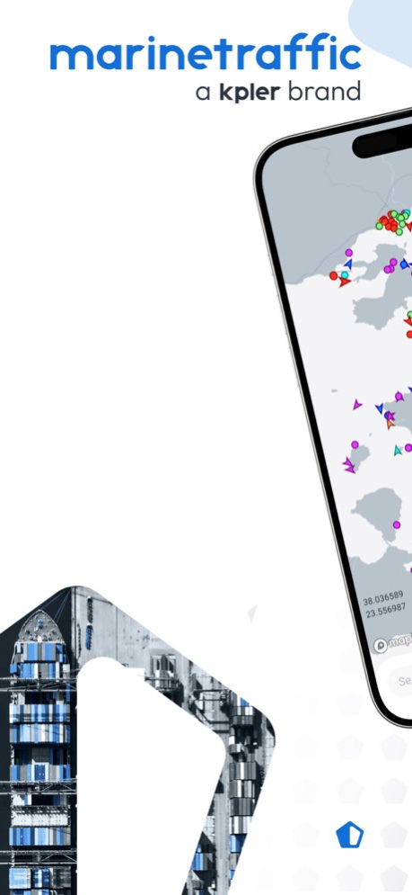
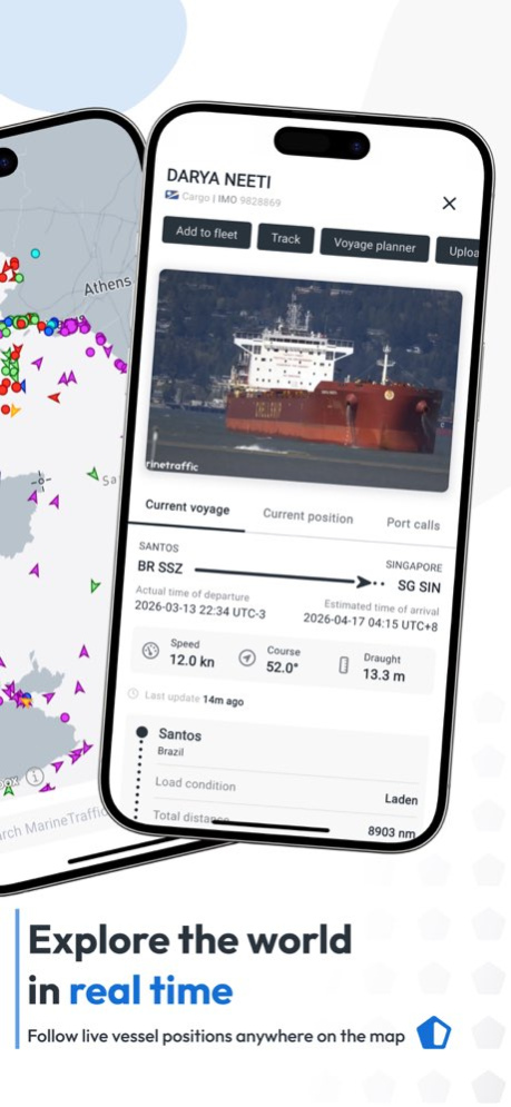
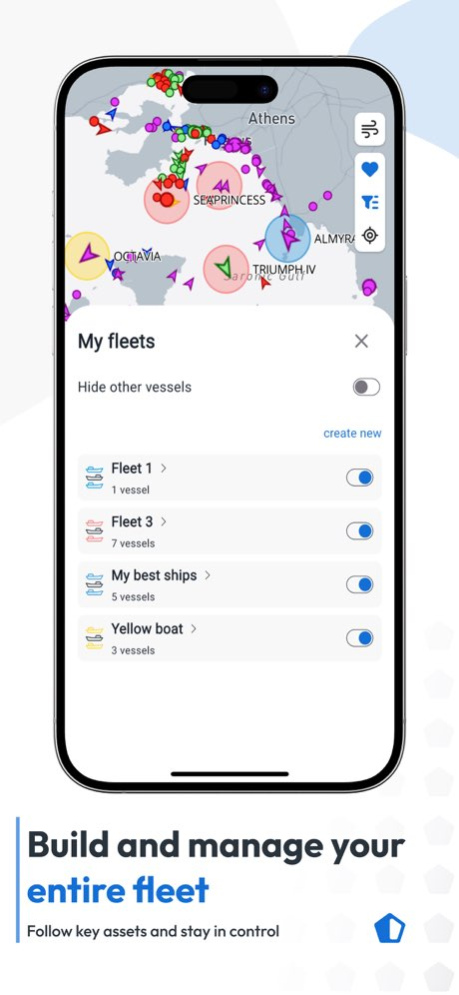
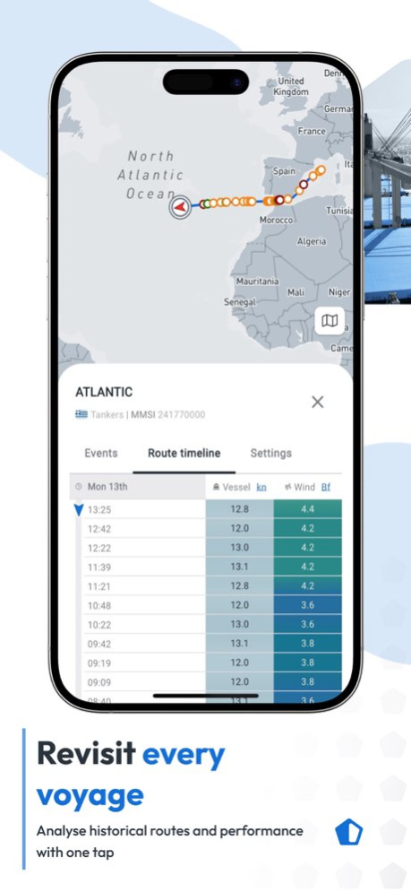
Welcome to MarineTraffic. You spoke, we listened. Based on feedback from our customers, the MarineTraffic app has been updated to deliver a faster, clearer, and more reliable way to track vessels and monitor maritime activity worldwide. MarineTraffic is used by maritime professionals, shipping companies, port authorities, and enthusiasts around the world. With MarineTraffic 2.0, the experience you rely on has been improved, while keeping the core tools you already know and trust. If you’ve used MarineTraffic before, you’ll feel at home straight away. The main features remain familiar, now supported by better performance, clearer maps, and a more stable foundation built for the future. With MarineTraffic, you can: Track vessels live worldwide using AIS data View ship positions, movements, and voyage history with key events along the route Build and monitor your chosen fleet by following specific vessels Access detailed vessel information such as type, destination, speed, and course Explore enhanced maps with close weather monitoring, including wind conditions A unified MarineTraffic experience The new MarineTraffic brings core tools together into one unified mobile app experience. The new app focuses on clarity, reliability, and ease of use, improving performance while keeping the experience familiar. Maps load faster, interactions feel smoother, and information is presented more clearly, supporting both everyday use and professional maritime workflows. What’s improved in MarineTraffic: Faster performance across maps and weather views Clearer visuals and smoother interactions throughout the app Improved platform stability and reliability All your key tools in one app, including close weather monitoring Unlock more with the Mobile Pro Plan The Mobile Pro Plan brings advanced capabilities together for users who need deeper visibility and extended coverage. With Mobile Pro, you can: Track vessels beyond coastal coverage using Satellite AIS, including activity in open oceans Access advanced fleet monitoring tools for wider oversight Follow vessels with extended historical data and deeper insights Gain access to additional maritime data layers for professional use Mobile Pro expands your vessel tracking capabilities when standard AIS coverage is not enough. Mobile Pro is designed for users who need a broader, more complete view of global vessel movement. Designed for real-world use MarineTraffic is used in many different ways, from fleet management to vessel tracking. MarineTraffic is designed to support these use cases without adding unnecessary complexity. You can follow vessels and fleets important to you, set up alerts, and explore global vessel traffic in real time. Vessel details, voyage history, and close weather monitoring are accessible in one place, helping you stay informed without switching between tools. MarineTraffic builds on everything users already rely on, with a faster, clearer, and more dependable mobile experience designed to support maritime activity around the world. Download MarineTraffic to explore global vessel traffic with improved speed, clarity, and reliability. --- Terms of Use (EULA): https://www.apple.com/legal/internet-services/itunes/dev/stdeula/ Privacy Policy: https://www.marinetraffic.com/en/p/privacy-policy Subscriptions auto-renew at the end of each billing period unless cancelled at least 24 hours before the renewal date. Renewals are charged to your Apple ID account. You can manage and cancel your subscription in your App Store account settings after purchase.
Version History Minor fixes and improvements 5.8.8 9h ago - Authentication improvements: fewer unexpected logouts, less friction when accessing Mobile Pro Plan and a smoother sign-in experience. - Vessel details now show reported AIS destination and reported ETA (Mobile Pro Plan users can see the crew's entered information). 5.8.7 Sep 26 Minor fixes and improvements. 5.8.5 Sep 11 Minor fixes and improvements 5.8.4 Sep 1 Minor fixes and improvements. 5.8.3 Aug 20 Minor fixes and improvements 5.8.1 Aug 17 New features: - Route Forecast (Mobile Pro) : See where a vessel is heading and what weather it will meet on the way. Scrub the timeline to follow the route point by point with wind each step. - Prediction vectors (Mobile Pro) : Now cover the next 30 minutes for every vessel. - When zooming, a new scale bar shows distances in both nautical miles and kilometres. - Vessel length and width are now visible without a subscription. - A Voyage Planner user guide is now available at the top of the page. - Port call lists now show country flags. Fixes: - Fixed an issue where, sometimes, a vessel's position could be out of date after the map refreshed. - Fixed an issue where vessels that don't report their size could be drawn at the wrong scale on the map. - Small UI improvements in My Fleets and Voyage Planner. - On Android, fixed an issue where some external web links could fail to open. 5.8.0 Aug 3 Fixes - Fixed an issue where Android user location was incorrect on app opening - Improved readability of wind direction on nautical maps - Fixed logout issue - sessions now last longer, reducing unexpected automatic logouts Improvements - Added a new setting to choose your preferred distance unit (nm, km, or miles) - Improved loading experience in the Voyage Planner - Refreshed Augmented Reality map overlay for improved accuracy 5.7.2 Jul 16 Voyage Planner enhancements Map pinpoint selection : tap anywhere on the map to set a point, and use it to measure distances directly. Multi-leg voyages : plan trips with multiple stops in a single voyage, instead of point-to-point only. New timezone setting You can now choose how times are displayed across the app: UTC, Local time, or Device time. Find it in Units settings. Wind detail bug fix Fixed an issue affecting the accuracy of wind detail information. 5.7.1 Jul 6 Minor fix and improvements 5.7.0 Jul 3 - Multiple bug fixes and small improvements 5.6.0 May 28 - Smoother, more harmonized navigation across the app - Wind details added to port and ship sheets - Vessel tracks now colored by speed - Multiple bug fixes and small improvements 5.4.1 May 20 - Smoother, more harmonized navigation across the app - Wind details added to port and ship sheets - Vessel tracks now colored by speed - Multiple bug fixes and small improvements 5.4.0 May 12 Plan your voyages directly from the app! The full Voyage Planner is now available : calculate routes, distances, and ETAs on the go. Improvements & Bug fixes - Smoother zoom when tapping on a vessel - Ship names displayed closer to their icon - Larger map refresh button for low-connectivity areas - Port calls fully aligned with the web app - Fixed vessels not appearing at certain zoom levels - Fixed Class B vessel characteristics showing errors 5.3.1 Apr 24 Plan your voyages directly from the app! The full Voyage Planner is now available : calculate routes, distances, and ETAs on the go. Improvements & Bug fixes - Smoother zoom when tapping on a vessel - Ship names displayed closer to their icon - Larger map refresh button for low-connectivity areas - Port calls fully aligned with the web app - Fixed vessels not appearing at certain zoom levels - Fixed Class B vessel characteristics showing errors 5.3.0 Apr 24 Bug Fixes • Text display issue (formatting) - Some users with a large device text size were experiencing hidden/cut-off text in the app. → The device text size setting will no longer affect the app. All users will now see all text correctly regardless of their device font size. • Filtered ships reappearing - Ships that were filtered out were incorrectly reappearing when opening a detail page. This edge case will be fixed in next version • Special characters in ship names - Ships with special characters (e.g. Mike O'Leary) can now be searched and found correctly in the mobile app. New Feature • Coordinate format in unit settings - Users will be able to update coordinate formats directly in the units bottom sheet, choosing between DD, DDM, or DMS 5.2.1 Apr 15 Bug fixes and map improvements. 5.2.0 Apr 8 Welcome to the new and improved MarineTraffic You spoke, we listened. Based on years of feedback, MarineTraffic has been updated to deliver a faster, clearer, and more dependable way to monitor marine traffic and use a powerful vessel tracker for ships worldwide. If you’ve used MarineTraffic before, you’ll feel at home straight away. The main features remain familiar, now supported by clearer maps, smoother interactions, and a more robust foundation built for long-term use. 5.1.10 Mar 25 Welcome to the new and improved MarineTraffic You spoke, we listened. Based on years of feedback, MarineTraffic has been updated to deliver a faster, clearer, and more dependable way to monitor marine traffic and use a powerful vessel tracker for ships worldwide. If you’ve used MarineTraffic before, you’ll feel at home straight away. The main features remain familiar, now supported by clearer maps, smoother interactions, and a more robust foundation built for long-term use. 5.1.9 Mar 20 Welcome to the new and improved MarineTraffic You spoke, we listened. Based on years of feedback, MarineTraffic has been updated to deliver a faster, clearer, and more dependable way to monitor marine traffic and use a powerful vessel tracker for ships worldwide. If you’ve used MarineTraffic before, you’ll feel at home straight away. The main features remain familiar, now supported by clearer maps, smoother interactions, and a more robust foundation built for long-term use. 5.1.8 Mar 17 A unified MarineTraffic experience The new MarineTraffic brings core tools together into one unified mobile app experience. The new app focuses on clarity, reliability, and ease of use, improving performance while keeping the experience familiar. Maps load faster, interactions feel smoother, and information is presented more clearly, supporting both everyday use and professional maritime workflows. What’s improved in MarineTraffic: Faster performance across maps and weather views Clearer visuals and smoother interactions throughout the app Improved platform stability and reliability Unlock more with the Mobile Pro Plan The Mobile Pro Plan brings advanced capabilities together for users who need deeper visibility and extended coverage. With Mobile Pro, you can: Track vessels beyond coastal coverage using Satellite AIS, including activity in open oceans Access advanced fleet monitoring tools for wider oversight Follow vessels with extended historical data and deeper insights Gain access to additional maritime data layers for professional use Mobile Pro expands your vessel tracking capabilities when standard AIS coverage is not enough. Mobile Pro is designed for users who need a broader, more complete view of global vessel movement. 5.1.5 Mar 11 - Fixes issue with Augmented Reality - Other fixes and improvements 4.2.6 Jan 16 - Fixes issue with iPhone 17 Pro Max - Other fixes and improvements 4.1.93 12/08/2025 - Fixed issue with advanced weather maps - Other fixes and improvements 4.1.86 10/18/2025 - Support for iPhone 17 series - Fixes and improvements 4.1.80 10/06/2025
Previous Versions
Here you can find the changelog of MarineTraffic - Ship Tracking since it was posted on our website on 2016-09-26 22:57:36.
The latest version is 5.8.8 and it was updated on 2026-10-14 18:25:09. See below the changes in each version.
MarineTraffic - Ship Tracking version 5.8.8
Updated At: 2026-10-14
Changes: Version History Minor fixes and improvements 5.8.8 9h ago - Authentication improvements: fewer unexpected logouts, less friction when accessing Mobile Pro Plan and a smoother sign-in experience.
- Vessel details now show reported AIS destination and reported ETA (Mobile Pro Plan users can see the crew's entered information). 5.8.7 Sep 26 Minor fixes and improvements. 5.8.5 Sep 11 Minor fixes and improvements 5.8.4 Sep 1 Minor fixes and improvements. 5.8.3 Aug 20 Minor fixes and improvements 5.8.1 Aug 17 New features:
- Route Forecast (Mobile Pro) : See where a vessel is heading and what weather it will meet on the way. Scrub the timeline to follow the route point by point with wind each step.
- Prediction vectors (Mobile Pro) : Now cover the next 30 minutes for every vessel.
- When zooming, a new scale bar shows distances in both nautical miles and kilometres.
- Vessel length and width are now visible without a subscription.
- A Voyage Planner user guide is now available at the top of the page.
- Port call lists now show country flags.
Fixes:
- Fixed an issue where, sometimes, a vessel's position could be out of date after the map refreshed.
- Fixed an issue where vessels that don't report their size could be drawn at the wrong scale on the map.
- Small UI improvements in My Fleets and Voyage Planner.
- On Android, fixed an issue where some external web links could fail to open. 5.8.0 Aug 3 Fixes
- Fixed an issue where Android user location was incorrect on app opening
- Improved readability of wind direction on nautical maps
- Fixed logout issue - sessions now last longer, reducing unexpected automatic logouts
Improvements
- Added a new setting to choose your preferred distance unit (nm, km, or miles)
- Improved loading experience in the Voyage Planner
- Refreshed Augmented Reality map overlay for improved accuracy 5.7.2 Jul 16 Voyage Planner enhancements
Map pinpoint selection : tap anywhere on the map to set a point, and use it to measure distances directly.
Multi-leg voyages : plan trips with multiple stops in a single voyage, instead of point-to-point only.
New timezone setting
You can now choose how times are displayed across the app: UTC, Local time, or Device time. Find it in Units settings.
Wind detail bug fix
Fixed an issue affecting the accuracy of wind detail information. 5.7.1 Jul 6 Minor fix and improvements 5.7.0 Jul 3 - Multiple bug fixes and small improvements 5.6.0 May 28 - Smoother, more harmonized navigation across the app
- Wind details added to port and ship sheets
- Vessel tracks now colored by speed
- Multiple bug fixes and small improvements 5.4.1 May 20 - Smoother, more harmonized navigation across the app
- Wind details added to port and ship sheets
- Vessel tracks now colored by speed
- Multiple bug fixes and small improvements 5.4.0 May 12 Plan your voyages directly from the app! The full Voyage Planner is now available : calculate routes, distances, and ETAs on the go.
Improvements & Bug fixes
- Smoother zoom when tapping on a vessel
- Ship names displayed closer to their icon
- Larger map refresh button for low-connectivity areas
- Port calls fully aligned with the web app
- Fixed vessels not appearing at certain zoom levels
- Fixed Class B vessel characteristics showing errors 5.3.1 Apr 24 Plan your voyages directly from the app! The full Voyage Planner is now available : calculate routes, distances, and ETAs on the go.
Improvements & Bug fixes
- Smoother zoom when tapping on a vessel
- Ship names displayed closer to their icon
- Larger map refresh button for low-connectivity areas
- Port calls fully aligned with the web app
- Fixed vessels not appearing at certain zoom levels
- Fixed Class B vessel characteristics showing errors 5.3.0 Apr 24 Bug Fixes
• Text display issue (formatting) - Some users with a large device text size were experiencing hidden/cut-off text in the app.
→ The device text size setting will no longer affect the app. All users will now see all text correctly regardless of their device font size.
• Filtered ships reappearing - Ships that were filtered out were incorrectly reappearing when opening a detail page. This edge case will be fixed in next version
• Special characters in ship names - Ships with special characters (e.g. Mike O'Leary) can now be searched and found correctly in the mobile app.
New Feature
• Coordinate format in unit settings - Users will be able to update coordinate formats directly in the units bottom sheet, choosing between DD, DDM, or DMS 5.2.1 Apr 15 Bug fixes and map improvements. 5.2.0 Apr 8 Welcome to the new and improved MarineTraffic
You spoke, we listened. Based on years of feedback, MarineTraffic has been updated to deliver a faster, clearer, and more dependable way to monitor marine traffic and use a powerful vessel tracker for ships worldwide.
If you’ve used MarineTraffic before, you’ll feel at home straight away. The main features remain familiar, now supported by clearer maps, smoother interactions, and a more robust foundation built for long-term use. 5.1.10 Mar 25 Welcome to the new and improved MarineTraffic
You spoke, we listened. Based on years of feedback, MarineTraffic has been updated to deliver a faster, clearer, and more dependable way to monitor marine traffic and use a powerful vessel tracker for ships worldwide.
If you’ve used MarineTraffic before, you’ll feel at home straight away. The main features remain familiar, now supported by clearer maps, smoother interactions, and a more robust foundation built for long-term use. 5.1.9 Mar 20 Welcome to the new and improved MarineTraffic You spoke, we listened. Based on years of feedback, MarineTraffic has been updated to deliver a faster, clearer, and more dependable way to monitor marine traffic and use a powerful vessel tracker for ships worldwide. If you’ve used MarineTraffic before, you’ll feel at home straight away. The main features remain familiar, now supported by clearer maps, smoother interactions, and a more robust foundation built for long-term use. 5.1.8 Mar 17 A unified MarineTraffic experience
The new MarineTraffic brings core tools together into one unified mobile app experience. The new app focuses on clarity, reliability, and ease of use, improving performance while keeping the experience familiar.
Maps load faster, interactions feel smoother, and information is presented more clearly, supporting both everyday use and professional maritime workflows.
What’s improved in MarineTraffic:
Faster performance across maps and weather views
Clearer visuals and smoother interactions throughout the app
Improved platform stability and reliability
Unlock more with the Mobile Pro Plan
The Mobile Pro Plan brings advanced capabilities together for users who need deeper visibility and extended coverage.
With Mobile Pro, you can:
Track vessels beyond coastal coverage using Satellite AIS, including activity in open oceans
Access advanced fleet monitoring tools for wider oversight
Follow vessels with extended historical data and deeper insights
Gain access to additional maritime data layers for professional use
Mobile Pro expands your vessel tracking capabilities when standard AIS coverage is not enough.
Mobile Pro is designed for users who need a broader, more complete view of global vessel movement. 5.1.5 Mar 11 - Fixes issue with Augmented Reality
- Other fixes and improvements 4.2.6 Jan 16 - Fixes issue with iPhone 17 Pro Max
- Other fixes and improvements 4.1.93 12/08/2025 - Fixed issue with advanced weather maps
- Other fixes and improvements 4.1.86 10/18/2025 - Support for iPhone 17 series
- Fixes and improvements 4.1.80 10/06/2025
MarineTraffic - Ship Tracking version 5.8.7
Updated At: 2026-10-07
Changes: Version History - Authentication improvements: fewer unexpected logouts, less friction when accessing Mobile Pro Plan and a smoother sign-in experience.
- Vessel details now show reported AIS destination and reported ETA (Mobile Pro Plan users can see the crew's entered information). 5.8.7 Sep 26 Minor fixes and improvements. 5.8.5 Sep 11 Minor fixes and improvements 5.8.4 Sep 1 Minor fixes and improvements. 5.8.3 Aug 20 Minor fixes and improvements 5.8.1 Aug 17 New features:
- Route Forecast (Mobile Pro) : See where a vessel is heading and what weather it will meet on the way. Scrub the timeline to follow the route point by point with wind each step.
- Prediction vectors (Mobile Pro) : Now cover the next 30 minutes for every vessel.
- When zooming, a new scale bar shows distances in both nautical miles and kilometres.
- Vessel length and width are now visible without a subscription.
- A Voyage Planner user guide is now available at the top of the page.
- Port call lists now show country flags.
Fixes:
- Fixed an issue where, sometimes, a vessel's position could be out of date after the map refreshed.
- Fixed an issue where vessels that don't report their size could be drawn at the wrong scale on the map.
- Small UI improvements in My Fleets and Voyage Planner.
- On Android, fixed an issue where some external web links could fail to open. 5.8.0 Aug 3 Fixes
- Fixed an issue where Android user location was incorrect on app opening
- Improved readability of wind direction on nautical maps
- Fixed logout issue - sessions now last longer, reducing unexpected automatic logouts
Improvements
- Added a new setting to choose your preferred distance unit (nm, km, or miles)
- Improved loading experience in the Voyage Planner
- Refreshed Augmented Reality map overlay for improved accuracy 5.7.2 Jul 16 Voyage Planner enhancements
Map pinpoint selection : tap anywhere on the map to set a point, and use it to measure distances directly.
Multi-leg voyages : plan trips with multiple stops in a single voyage, instead of point-to-point only.
New timezone setting
You can now choose how times are displayed across the app: UTC, Local time, or Device time. Find it in Units settings.
Wind detail bug fix
Fixed an issue affecting the accuracy of wind detail information. 5.7.1 Jul 6 Minor fix and improvements 5.7.0 Jul 3 - Multiple bug fixes and small improvements 5.6.0 May 28 - Smoother, more harmonized navigation across the app
- Wind details added to port and ship sheets
- Vessel tracks now colored by speed
- Multiple bug fixes and small improvements 5.4.1 May 20 - Smoother, more harmonized navigation across the app
- Wind details added to port and ship sheets
- Vessel tracks now colored by speed
- Multiple bug fixes and small improvements 5.4.0 May 12 Plan your voyages directly from the app! The full Voyage Planner is now available : calculate routes, distances, and ETAs on the go.
Improvements & Bug fixes
- Smoother zoom when tapping on a vessel
- Ship names displayed closer to their icon
- Larger map refresh button for low-connectivity areas
- Port calls fully aligned with the web app
- Fixed vessels not appearing at certain zoom levels
- Fixed Class B vessel characteristics showing errors 5.3.1 Apr 24 Plan your voyages directly from the app! The full Voyage Planner is now available : calculate routes, distances, and ETAs on the go.
Improvements & Bug fixes
- Smoother zoom when tapping on a vessel
- Ship names displayed closer to their icon
- Larger map refresh button for low-connectivity areas
- Port calls fully aligned with the web app
- Fixed vessels not appearing at certain zoom levels
- Fixed Class B vessel characteristics showing errors 5.3.0 Apr 24 Bug Fixes
• Text display issue (formatting) - Some users with a large device text size were experiencing hidden/cut-off text in the app.
→ The device text size setting will no longer affect the app. All users will now see all text correctly regardless of their device font size.
• Filtered ships reappearing - Ships that were filtered out were incorrectly reappearing when opening a detail page. This edge case will be fixed in next version
• Special characters in ship names - Ships with special characters (e.g. Mike O'Leary) can now be searched and found correctly in the mobile app.
New Feature
• Coordinate format in unit settings - Users will be able to update coordinate formats directly in the units bottom sheet, choosing between DD, DDM, or DMS 5.2.1 Apr 15 Bug fixes and map improvements. 5.2.0 Apr 8 Welcome to the new and improved MarineTraffic
You spoke, we listened. Based on years of feedback, MarineTraffic has been updated to deliver a faster, clearer, and more dependable way to monitor marine traffic and use a powerful vessel tracker for ships worldwide.
If you’ve used MarineTraffic before, you’ll feel at home straight away. The main features remain familiar, now supported by clearer maps, smoother interactions, and a more robust foundation built for long-term use. 5.1.10 Mar 25 Welcome to the new and improved MarineTraffic
You spoke, we listened. Based on years of feedback, MarineTraffic has been updated to deliver a faster, clearer, and more dependable way to monitor marine traffic and use a powerful vessel tracker for ships worldwide.
If you’ve used MarineTraffic before, you’ll feel at home straight away. The main features remain familiar, now supported by clearer maps, smoother interactions, and a more robust foundation built for long-term use. 5.1.9 Mar 20 Welcome to the new and improved MarineTraffic You spoke, we listened. Based on years of feedback, MarineTraffic has been updated to deliver a faster, clearer, and more dependable way to monitor marine traffic and use a powerful vessel tracker for ships worldwide. If you’ve used MarineTraffic before, you’ll feel at home straight away. The main features remain familiar, now supported by clearer maps, smoother interactions, and a more robust foundation built for long-term use. 5.1.8 Mar 17 A unified MarineTraffic experience
The new MarineTraffic brings core tools together into one unified mobile app experience. The new app focuses on clarity, reliability, and ease of use, improving performance while keeping the experience familiar.
Maps load faster, interactions feel smoother, and information is presented more clearly, supporting both everyday use and professional maritime workflows.
What’s improved in MarineTraffic:
Faster performance across maps and weather views
Clearer visuals and smoother interactions throughout the app
Improved platform stability and reliability
Unlock more with the Mobile Pro Plan
The Mobile Pro Plan brings advanced capabilities together for users who need deeper visibility and extended coverage.
With Mobile Pro, you can:
Track vessels beyond coastal coverage using Satellite AIS, including activity in open oceans
Access advanced fleet monitoring tools for wider oversight
Follow vessels with extended historical data and deeper insights
Gain access to additional maritime data layers for professional use
Mobile Pro expands your vessel tracking capabilities when standard AIS coverage is not enough.
Mobile Pro is designed for users who need a broader, more complete view of global vessel movement. 5.1.5 Mar 11 - Fixes issue with Augmented Reality
- Other fixes and improvements 4.2.6 Jan 16 - Fixes issue with iPhone 17 Pro Max
- Other fixes and improvements 4.1.93 12/08/2025 - Fixed issue with advanced weather maps
- Other fixes and improvements 4.1.86 10/18/2025 - Support for iPhone 17 series
- Fixes and improvements 4.1.80 10/06/2025 - Bug fixes and improvements 4.1.78 08/30/2025
MarineTraffic - Ship Tracking version 5.8.7
Updated At: 2026-09-26
Changes: Version History - Authentication improvements: fewer unexpected logouts, less friction when accessing Mobile Pro Plan and a smoother sign-in experience.
- Vessel details now show reported AIS destination and reported ETA (Mobile Pro Plan users can see the crew's entered information). 5.8.7 2h ago Minor fixes and improvements. 5.8.5 Sep 11 Minor fixes and improvements 5.8.4 Sep 1 Minor fixes and improvements. 5.8.3 Aug 20 Minor fixes and improvements 5.8.1 Aug 17 New features:
- Route Forecast (Mobile Pro) : See where a vessel is heading and what weather it will meet on the way. Scrub the timeline to follow the route point by point with wind each step.
- Prediction vectors (Mobile Pro) : Now cover the next 30 minutes for every vessel.
- When zooming, a new scale bar shows distances in both nautical miles and kilometres.
- Vessel length and width are now visible without a subscription.
- A Voyage Planner user guide is now available at the top of the page.
- Port call lists now show country flags.
Fixes:
- Fixed an issue where, sometimes, a vessel's position could be out of date after the map refreshed.
- Fixed an issue where vessels that don't report their size could be drawn at the wrong scale on the map.
- Small UI improvements in My Fleets and Voyage Planner.
- On Android, fixed an issue where some external web links could fail to open. 5.8.0 Aug 3 Fixes
- Fixed an issue where Android user location was incorrect on app opening
- Improved readability of wind direction on nautical maps
- Fixed logout issue - sessions now last longer, reducing unexpected automatic logouts
Improvements
- Added a new setting to choose your preferred distance unit (nm, km, or miles)
- Improved loading experience in the Voyage Planner
- Refreshed Augmented Reality map overlay for improved accuracy 5.7.2 Jul 16 Voyage Planner enhancements
Map pinpoint selection : tap anywhere on the map to set a point, and use it to measure distances directly.
Multi-leg voyages : plan trips with multiple stops in a single voyage, instead of point-to-point only.
New timezone setting
You can now choose how times are displayed across the app: UTC, Local time, or Device time. Find it in Units settings.
Wind detail bug fix
Fixed an issue affecting the accuracy of wind detail information. 5.7.1 Jul 6 Minor fix and improvements 5.7.0 Jul 3 - Multiple bug fixes and small improvements 5.6.0 May 28 - Smoother, more harmonized navigation across the app
- Wind details added to port and ship sheets
- Vessel tracks now colored by speed
- Multiple bug fixes and small improvements 5.4.1 May 20 - Smoother, more harmonized navigation across the app
- Wind details added to port and ship sheets
- Vessel tracks now colored by speed
- Multiple bug fixes and small improvements 5.4.0 May 12 Plan your voyages directly from the app! The full Voyage Planner is now available : calculate routes, distances, and ETAs on the go.
Improvements & Bug fixes
- Smoother zoom when tapping on a vessel
- Ship names displayed closer to their icon
- Larger map refresh button for low-connectivity areas
- Port calls fully aligned with the web app
- Fixed vessels not appearing at certain zoom levels
- Fixed Class B vessel characteristics showing errors 5.3.1 Apr 24 Plan your voyages directly from the app! The full Voyage Planner is now available : calculate routes, distances, and ETAs on the go.
Improvements & Bug fixes
- Smoother zoom when tapping on a vessel
- Ship names displayed closer to their icon
- Larger map refresh button for low-connectivity areas
- Port calls fully aligned with the web app
- Fixed vessels not appearing at certain zoom levels
- Fixed Class B vessel characteristics showing errors 5.3.0 Apr 24 Bug Fixes
• Text display issue (formatting) - Some users with a large device text size were experiencing hidden/cut-off text in the app.
→ The device text size setting will no longer affect the app. All users will now see all text correctly regardless of their device font size.
• Filtered ships reappearing - Ships that were filtered out were incorrectly reappearing when opening a detail page. This edge case will be fixed in next version
• Special characters in ship names - Ships with special characters (e.g. Mike O'Leary) can now be searched and found correctly in the mobile app.
New Feature
• Coordinate format in unit settings - Users will be able to update coordinate formats directly in the units bottom sheet, choosing between DD, DDM, or DMS 5.2.1 Apr 15 Bug fixes and map improvements. 5.2.0 Apr 8 Welcome to the new and improved MarineTraffic
You spoke, we listened. Based on years of feedback, MarineTraffic has been updated to deliver a faster, clearer, and more dependable way to monitor marine traffic and use a powerful vessel tracker for ships worldwide.
If you’ve used MarineTraffic before, you’ll feel at home straight away. The main features remain familiar, now supported by clearer maps, smoother interactions, and a more robust foundation built for long-term use. 5.1.10 Mar 25 Welcome to the new and improved MarineTraffic
You spoke, we listened. Based on years of feedback, MarineTraffic has been updated to deliver a faster, clearer, and more dependable way to monitor marine traffic and use a powerful vessel tracker for ships worldwide.
If you’ve used MarineTraffic before, you’ll feel at home straight away. The main features remain familiar, now supported by clearer maps, smoother interactions, and a more robust foundation built for long-term use. 5.1.9 Mar 20 Welcome to the new and improved MarineTraffic You spoke, we listened. Based on years of feedback, MarineTraffic has been updated to deliver a faster, clearer, and more dependable way to monitor marine traffic and use a powerful vessel tracker for ships worldwide. If you’ve used MarineTraffic before, you’ll feel at home straight away. The main features remain familiar, now supported by clearer maps, smoother interactions, and a more robust foundation built for long-term use. 5.1.8 Mar 17 A unified MarineTraffic experience
The new MarineTraffic brings core tools together into one unified mobile app experience. The new app focuses on clarity, reliability, and ease of use, improving performance while keeping the experience familiar.
Maps load faster, interactions feel smoother, and information is presented more clearly, supporting both everyday use and professional maritime workflows.
What’s improved in MarineTraffic:
Faster performance across maps and weather views
Clearer visuals and smoother interactions throughout the app
Improved platform stability and reliability
Unlock more with the Mobile Pro Plan
The Mobile Pro Plan brings advanced capabilities together for users who need deeper visibility and extended coverage.
With Mobile Pro, you can:
Track vessels beyond coastal coverage using Satellite AIS, including activity in open oceans
Access advanced fleet monitoring tools for wider oversight
Follow vessels with extended historical data and deeper insights
Gain access to additional maritime data layers for professional use
Mobile Pro expands your vessel tracking capabilities when standard AIS coverage is not enough.
Mobile Pro is designed for users who need a broader, more complete view of global vessel movement. 5.1.5 Mar 11 - Fixes issue with Augmented Reality
- Other fixes and improvements 4.2.6 Jan 16 - Fixes issue with iPhone 17 Pro Max
- Other fixes and improvements 4.1.93 12/08/2025 - Fixed issue with advanced weather maps
- Other fixes and improvements 4.1.86 10/18/2025 - Support for iPhone 17 series
- Fixes and improvements 4.1.80 10/06/2025 - Bug fixes and improvements 4.1.78 08/30/2025
MarineTraffic - Ship Tracking version 5.8.5
Updated At: 2026-09-19
Changes: Version History Minor fixes and improvements. 5.8.5 Sep 11 Minor fixes and improvements 5.8.4 Sep 1 Minor fixes and improvements. 5.8.3 Aug 20 Minor fixes and improvements 5.8.1 Aug 17 New features:
- Route Forecast (Mobile Pro) : See where a vessel is heading and what weather it will meet on the way. Scrub the timeline to follow the route point by point with wind each step.
- Prediction vectors (Mobile Pro) : Now cover the next 30 minutes for every vessel.
- When zooming, a new scale bar shows distances in both nautical miles and kilometres.
- Vessel length and width are now visible without a subscription.
- A Voyage Planner user guide is now available at the top of the page.
- Port call lists now show country flags.
Fixes:
- Fixed an issue where, sometimes, a vessel's position could be out of date after the map refreshed.
- Fixed an issue where vessels that don't report their size could be drawn at the wrong scale on the map.
- Small UI improvements in My Fleets and Voyage Planner.
- On Android, fixed an issue where some external web links could fail to open. 5.8.0 Aug 3 Fixes
- Fixed an issue where Android user location was incorrect on app opening
- Improved readability of wind direction on nautical maps
- Fixed logout issue - sessions now last longer, reducing unexpected automatic logouts
Improvements
- Added a new setting to choose your preferred distance unit (nm, km, or miles)
- Improved loading experience in the Voyage Planner
- Refreshed Augmented Reality map overlay for improved accuracy 5.7.2 Jul 16 Voyage Planner enhancements
Map pinpoint selection : tap anywhere on the map to set a point, and use it to measure distances directly.
Multi-leg voyages : plan trips with multiple stops in a single voyage, instead of point-to-point only.
New timezone setting
You can now choose how times are displayed across the app: UTC, Local time, or Device time. Find it in Units settings.
Wind detail bug fix
Fixed an issue affecting the accuracy of wind detail information. 5.7.1 Jul 6 Minor fix and improvements 5.7.0 Jul 3 - Multiple bug fixes and small improvements 5.6.0 May 28 - Smoother, more harmonized navigation across the app
- Wind details added to port and ship sheets
- Vessel tracks now colored by speed
- Multiple bug fixes and small improvements 5.4.1 May 20 - Smoother, more harmonized navigation across the app
- Wind details added to port and ship sheets
- Vessel tracks now colored by speed
- Multiple bug fixes and small improvements 5.4.0 May 12 Plan your voyages directly from the app! The full Voyage Planner is now available : calculate routes, distances, and ETAs on the go.
Improvements & Bug fixes
- Smoother zoom when tapping on a vessel
- Ship names displayed closer to their icon
- Larger map refresh button for low-connectivity areas
- Port calls fully aligned with the web app
- Fixed vessels not appearing at certain zoom levels
- Fixed Class B vessel characteristics showing errors 5.3.1 Apr 24 Plan your voyages directly from the app! The full Voyage Planner is now available : calculate routes, distances, and ETAs on the go.
Improvements & Bug fixes
- Smoother zoom when tapping on a vessel
- Ship names displayed closer to their icon
- Larger map refresh button for low-connectivity areas
- Port calls fully aligned with the web app
- Fixed vessels not appearing at certain zoom levels
- Fixed Class B vessel characteristics showing errors 5.3.0 Apr 24 Bug Fixes
• Text display issue (formatting) - Some users with a large device text size were experiencing hidden/cut-off text in the app.
→ The device text size setting will no longer affect the app. All users will now see all text correctly regardless of their device font size.
• Filtered ships reappearing - Ships that were filtered out were incorrectly reappearing when opening a detail page. This edge case will be fixed in next version
• Special characters in ship names - Ships with special characters (e.g. Mike O'Leary) can now be searched and found correctly in the mobile app.
New Feature
• Coordinate format in unit settings - Users will be able to update coordinate formats directly in the units bottom sheet, choosing between DD, DDM, or DMS 5.2.1 Apr 15 Bug fixes and map improvements. 5.2.0 Apr 8 Welcome to the new and improved MarineTraffic
You spoke, we listened. Based on years of feedback, MarineTraffic has been updated to deliver a faster, clearer, and more dependable way to monitor marine traffic and use a powerful vessel tracker for ships worldwide.
If you’ve used MarineTraffic before, you’ll feel at home straight away. The main features remain familiar, now supported by clearer maps, smoother interactions, and a more robust foundation built for long-term use. 5.1.10 Mar 25 Welcome to the new and improved MarineTraffic
You spoke, we listened. Based on years of feedback, MarineTraffic has been updated to deliver a faster, clearer, and more dependable way to monitor marine traffic and use a powerful vessel tracker for ships worldwide.
If you’ve used MarineTraffic before, you’ll feel at home straight away. The main features remain familiar, now supported by clearer maps, smoother interactions, and a more robust foundation built for long-term use. 5.1.9 Mar 20 Welcome to the new and improved MarineTraffic You spoke, we listened. Based on years of feedback, MarineTraffic has been updated to deliver a faster, clearer, and more dependable way to monitor marine traffic and use a powerful vessel tracker for ships worldwide. If you’ve used MarineTraffic before, you’ll feel at home straight away. The main features remain familiar, now supported by clearer maps, smoother interactions, and a more robust foundation built for long-term use. 5.1.8 Mar 17 A unified MarineTraffic experience
The new MarineTraffic brings core tools together into one unified mobile app experience. The new app focuses on clarity, reliability, and ease of use, improving performance while keeping the experience familiar.
Maps load faster, interactions feel smoother, and information is presented more clearly, supporting both everyday use and professional maritime workflows.
What’s improved in MarineTraffic:
Faster performance across maps and weather views
Clearer visuals and smoother interactions throughout the app
Improved platform stability and reliability
Unlock more with the Mobile Pro Plan
The Mobile Pro Plan brings advanced capabilities together for users who need deeper visibility and extended coverage.
With Mobile Pro, you can:
Track vessels beyond coastal coverage using Satellite AIS, including activity in open oceans
Access advanced fleet monitoring tools for wider oversight
Follow vessels with extended historical data and deeper insights
Gain access to additional maritime data layers for professional use
Mobile Pro expands your vessel tracking capabilities when standard AIS coverage is not enough.
Mobile Pro is designed for users who need a broader, more complete view of global vessel movement. 5.1.5 Mar 11 - Fixes issue with Augmented Reality
- Other fixes and improvements 4.2.6 Jan 16 - Fixes issue with iPhone 17 Pro Max
- Other fixes and improvements 4.1.93 12/08/2025 - Fixed issue with advanced weather maps
- Other fixes and improvements 4.1.86 10/18/2025 - Support for iPhone 17 series
- Fixes and improvements 4.1.80 10/06/2025 - Bug fixes and improvements 4.1.78 08/30/2025 - Map layers update
- Support for iPhone 16e
- Bug fixes and improvements 4.1.62 06/26/2025
MarineTraffic - Ship Tracking version 5.8.5
Updated At: 2026-09-12
Changes: Version History Minor fixes and improvements. 5.8.5 21h ago Minor fixes and improvements 5.8.4 Sep 1 Minor fixes and improvements. 5.8.3 Aug 20 Minor fixes and improvements 5.8.1 Aug 17 New features:
- Route Forecast (Mobile Pro) : See where a vessel is heading and what weather it will meet on the way. Scrub the timeline to follow the route point by point with wind each step.
- Prediction vectors (Mobile Pro) : Now cover the next 30 minutes for every vessel.
- When zooming, a new scale bar shows distances in both nautical miles and kilometres.
- Vessel length and width are now visible without a subscription.
- A Voyage Planner user guide is now available at the top of the page.
- Port call lists now show country flags.
Fixes:
- Fixed an issue where, sometimes, a vessel's position could be out of date after the map refreshed.
- Fixed an issue where vessels that don't report their size could be drawn at the wrong scale on the map.
- Small UI improvements in My Fleets and Voyage Planner.
- On Android, fixed an issue where some external web links could fail to open. 5.8.0 Aug 3 Fixes
- Fixed an issue where Android user location was incorrect on app opening
- Improved readability of wind direction on nautical maps
- Fixed logout issue - sessions now last longer, reducing unexpected automatic logouts
Improvements
- Added a new setting to choose your preferred distance unit (nm, km, or miles)
- Improved loading experience in the Voyage Planner
- Refreshed Augmented Reality map overlay for improved accuracy 5.7.2 Jul 16 Voyage Planner enhancements
Map pinpoint selection : tap anywhere on the map to set a point, and use it to measure distances directly.
Multi-leg voyages : plan trips with multiple stops in a single voyage, instead of point-to-point only.
New timezone setting
You can now choose how times are displayed across the app: UTC, Local time, or Device time. Find it in Units settings.
Wind detail bug fix
Fixed an issue affecting the accuracy of wind detail information. 5.7.1 Jul 6 Minor fix and improvements 5.7.0 Jul 3 - Multiple bug fixes and small improvements 5.6.0 May 28 - Smoother, more harmonized navigation across the app
- Wind details added to port and ship sheets
- Vessel tracks now colored by speed
- Multiple bug fixes and small improvements 5.4.1 May 20 - Smoother, more harmonized navigation across the app
- Wind details added to port and ship sheets
- Vessel tracks now colored by speed
- Multiple bug fixes and small improvements 5.4.0 May 12 Plan your voyages directly from the app! The full Voyage Planner is now available : calculate routes, distances, and ETAs on the go.
Improvements & Bug fixes
- Smoother zoom when tapping on a vessel
- Ship names displayed closer to their icon
- Larger map refresh button for low-connectivity areas
- Port calls fully aligned with the web app
- Fixed vessels not appearing at certain zoom levels
- Fixed Class B vessel characteristics showing errors 5.3.1 Apr 24 Plan your voyages directly from the app! The full Voyage Planner is now available : calculate routes, distances, and ETAs on the go.
Improvements & Bug fixes
- Smoother zoom when tapping on a vessel
- Ship names displayed closer to their icon
- Larger map refresh button for low-connectivity areas
- Port calls fully aligned with the web app
- Fixed vessels not appearing at certain zoom levels
- Fixed Class B vessel characteristics showing errors 5.3.0 Apr 24 Bug Fixes
• Text display issue (formatting) - Some users with a large device text size were experiencing hidden/cut-off text in the app.
→ The device text size setting will no longer affect the app. All users will now see all text correctly regardless of their device font size.
• Filtered ships reappearing - Ships that were filtered out were incorrectly reappearing when opening a detail page. This edge case will be fixed in next version
• Special characters in ship names - Ships with special characters (e.g. Mike O'Leary) can now be searched and found correctly in the mobile app.
New Feature
• Coordinate format in unit settings - Users will be able to update coordinate formats directly in the units bottom sheet, choosing between DD, DDM, or DMS 5.2.1 Apr 15 Bug fixes and map improvements. 5.2.0 Apr 8 Welcome to the new and improved MarineTraffic
You spoke, we listened. Based on years of feedback, MarineTraffic has been updated to deliver a faster, clearer, and more dependable way to monitor marine traffic and use a powerful vessel tracker for ships worldwide.
If you’ve used MarineTraffic before, you’ll feel at home straight away. The main features remain familiar, now supported by clearer maps, smoother interactions, and a more robust foundation built for long-term use. 5.1.10 Mar 25 Welcome to the new and improved MarineTraffic
You spoke, we listened. Based on years of feedback, MarineTraffic has been updated to deliver a faster, clearer, and more dependable way to monitor marine traffic and use a powerful vessel tracker for ships worldwide.
If you’ve used MarineTraffic before, you’ll feel at home straight away. The main features remain familiar, now supported by clearer maps, smoother interactions, and a more robust foundation built for long-term use. 5.1.9 Mar 20 Welcome to the new and improved MarineTraffic You spoke, we listened. Based on years of feedback, MarineTraffic has been updated to deliver a faster, clearer, and more dependable way to monitor marine traffic and use a powerful vessel tracker for ships worldwide. If you’ve used MarineTraffic before, you’ll feel at home straight away. The main features remain familiar, now supported by clearer maps, smoother interactions, and a more robust foundation built for long-term use. 5.1.8 Mar 17 A unified MarineTraffic experience
The new MarineTraffic brings core tools together into one unified mobile app experience. The new app focuses on clarity, reliability, and ease of use, improving performance while keeping the experience familiar.
Maps load faster, interactions feel smoother, and information is presented more clearly, supporting both everyday use and professional maritime workflows.
What’s improved in MarineTraffic:
Faster performance across maps and weather views
Clearer visuals and smoother interactions throughout the app
Improved platform stability and reliability
Unlock more with the Mobile Pro Plan
The Mobile Pro Plan brings advanced capabilities together for users who need deeper visibility and extended coverage.
With Mobile Pro, you can:
Track vessels beyond coastal coverage using Satellite AIS, including activity in open oceans
Access advanced fleet monitoring tools for wider oversight
Follow vessels with extended historical data and deeper insights
Gain access to additional maritime data layers for professional use
Mobile Pro expands your vessel tracking capabilities when standard AIS coverage is not enough.
Mobile Pro is designed for users who need a broader, more complete view of global vessel movement. 5.1.5 Mar 11 - Fixes issue with Augmented Reality
- Other fixes and improvements 4.2.6 Jan 16 - Fixes issue with iPhone 17 Pro Max
- Other fixes and improvements 4.1.93 12/08/2025 - Fixed issue with advanced weather maps
- Other fixes and improvements 4.1.86 10/18/2025 - Support for iPhone 17 series
- Fixes and improvements 4.1.80 10/06/2025 - Bug fixes and improvements 4.1.78 08/30/2025 - Map layers update
- Support for iPhone 16e
- Bug fixes and improvements 4.1.62 06/26/2025
MarineTraffic - Ship Tracking version 5.8.4
Updated At: 2026-09-04
Changes: Version History Minor fixes and improvements 5.8.4 3d ago Minor fixes and improvements. 5.8.3 Aug 20 Minor fixes and improvements 5.8.1 Aug 17 New features:
- Route Forecast (Mobile Pro) : See where a vessel is heading and what weather it will meet on the way. Scrub the timeline to follow the route point by point with wind each step.
- Prediction vectors (Mobile Pro) : Now cover the next 30 minutes for every vessel.
- When zooming, a new scale bar shows distances in both nautical miles and kilometres.
- Vessel length and width are now visible without a subscription.
- A Voyage Planner user guide is now available at the top of the page.
- Port call lists now show country flags.
Fixes:
- Fixed an issue where, sometimes, a vessel's position could be out of date after the map refreshed.
- Fixed an issue where vessels that don't report their size could be drawn at the wrong scale on the map.
- Small UI improvements in My Fleets and Voyage Planner.
- On Android, fixed an issue where some external web links could fail to open. 5.8.0 Aug 3 Fixes
- Fixed an issue where Android user location was incorrect on app opening
- Improved readability of wind direction on nautical maps
- Fixed logout issue - sessions now last longer, reducing unexpected automatic logouts
Improvements
- Added a new setting to choose your preferred distance unit (nm, km, or miles)
- Improved loading experience in the Voyage Planner
- Refreshed Augmented Reality map overlay for improved accuracy 5.7.2 Jul 16 Voyage Planner enhancements
Map pinpoint selection : tap anywhere on the map to set a point, and use it to measure distances directly.
Multi-leg voyages : plan trips with multiple stops in a single voyage, instead of point-to-point only.
New timezone setting
You can now choose how times are displayed across the app: UTC, Local time, or Device time. Find it in Units settings.
Wind detail bug fix
Fixed an issue affecting the accuracy of wind detail information. 5.7.1 Jul 6 Minor fix and improvements 5.7.0 Jul 3 - Multiple bug fixes and small improvements 5.6.0 May 28 - Smoother, more harmonized navigation across the app
- Wind details added to port and ship sheets
- Vessel tracks now colored by speed
- Multiple bug fixes and small improvements 5.4.1 May 20 - Smoother, more harmonized navigation across the app
- Wind details added to port and ship sheets
- Vessel tracks now colored by speed
- Multiple bug fixes and small improvements 5.4.0 May 12 Plan your voyages directly from the app! The full Voyage Planner is now available : calculate routes, distances, and ETAs on the go.
Improvements & Bug fixes
- Smoother zoom when tapping on a vessel
- Ship names displayed closer to their icon
- Larger map refresh button for low-connectivity areas
- Port calls fully aligned with the web app
- Fixed vessels not appearing at certain zoom levels
- Fixed Class B vessel characteristics showing errors 5.3.1 Apr 24 Plan your voyages directly from the app! The full Voyage Planner is now available : calculate routes, distances, and ETAs on the go.
Improvements & Bug fixes
- Smoother zoom when tapping on a vessel
- Ship names displayed closer to their icon
- Larger map refresh button for low-connectivity areas
- Port calls fully aligned with the web app
- Fixed vessels not appearing at certain zoom levels
- Fixed Class B vessel characteristics showing errors 5.3.0 Apr 24 Bug Fixes
• Text display issue (formatting) - Some users with a large device text size were experiencing hidden/cut-off text in the app.
→ The device text size setting will no longer affect the app. All users will now see all text correctly regardless of their device font size.
• Filtered ships reappearing - Ships that were filtered out were incorrectly reappearing when opening a detail page. This edge case will be fixed in next version
• Special characters in ship names - Ships with special characters (e.g. Mike O'Leary) can now be searched and found correctly in the mobile app.
New Feature
• Coordinate format in unit settings - Users will be able to update coordinate formats directly in the units bottom sheet, choosing between DD, DDM, or DMS 5.2.1 Apr 15 Bug fixes and map improvements. 5.2.0 Apr 8 Welcome to the new and improved MarineTraffic
You spoke, we listened. Based on years of feedback, MarineTraffic has been updated to deliver a faster, clearer, and more dependable way to monitor marine traffic and use a powerful vessel tracker for ships worldwide.
If you’ve used MarineTraffic before, you’ll feel at home straight away. The main features remain familiar, now supported by clearer maps, smoother interactions, and a more robust foundation built for long-term use. 5.1.10 Mar 25 Welcome to the new and improved MarineTraffic
You spoke, we listened. Based on years of feedback, MarineTraffic has been updated to deliver a faster, clearer, and more dependable way to monitor marine traffic and use a powerful vessel tracker for ships worldwide.
If you’ve used MarineTraffic before, you’ll feel at home straight away. The main features remain familiar, now supported by clearer maps, smoother interactions, and a more robust foundation built for long-term use. 5.1.9 Mar 20 Welcome to the new and improved MarineTraffic You spoke, we listened. Based on years of feedback, MarineTraffic has been updated to deliver a faster, clearer, and more dependable way to monitor marine traffic and use a powerful vessel tracker for ships worldwide. If you’ve used MarineTraffic before, you’ll feel at home straight away. The main features remain familiar, now supported by clearer maps, smoother interactions, and a more robust foundation built for long-term use. 5.1.8 Mar 17 A unified MarineTraffic experience
The new MarineTraffic brings core tools together into one unified mobile app experience. The new app focuses on clarity, reliability, and ease of use, improving performance while keeping the experience familiar.
Maps load faster, interactions feel smoother, and information is presented more clearly, supporting both everyday use and professional maritime workflows.
What’s improved in MarineTraffic:
Faster performance across maps and weather views
Clearer visuals and smoother interactions throughout the app
Improved platform stability and reliability
Unlock more with the Mobile Pro Plan
The Mobile Pro Plan brings advanced capabilities together for users who need deeper visibility and extended coverage.
With Mobile Pro, you can:
Track vessels beyond coastal coverage using Satellite AIS, including activity in open oceans
Access advanced fleet monitoring tools for wider oversight
Follow vessels with extended historical data and deeper insights
Gain access to additional maritime data layers for professional use
Mobile Pro expands your vessel tracking capabilities when standard AIS coverage is not enough.
Mobile Pro is designed for users who need a broader, more complete view of global vessel movement. 5.1.5 Mar 11 - Fixes issue with Augmented Reality
- Other fixes and improvements 4.2.6 Jan 16 - Fixes issue with iPhone 17 Pro Max
- Other fixes and improvements 4.1.93 12/08/2025 - Fixed issue with advanced weather maps
- Other fixes and improvements 4.1.86 10/18/2025 - Support for iPhone 17 series
- Fixes and improvements 4.1.80 10/06/2025 - Bug fixes and improvements 4.1.78 08/30/2025 - Map layers update
- Support for iPhone 16e
- Bug fixes and improvements 4.1.62 06/26/2025 - Fixes issue with lighthouses
- Fixes issue with photo rating
- Density Maps updates 4.1.42 03/13/2025
MarineTraffic - Ship Tracking version 5.8.3
Updated At: 2026-08-22
Changes: Version History Minor fixes and improvements. 5.8.3 2d ago Minor fixes and improvements 5.8.1 5d ago New features:
- Route Forecast (Mobile Pro) : See where a vessel is heading and what weather it will meet on the way. Scrub the timeline to follow the route point by point with wind each step.
- Prediction vectors (Mobile Pro) : Now cover the next 30 minutes for every vessel.
- When zooming, a new scale bar shows distances in both nautical miles and kilometres.
- Vessel length and width are now visible without a subscription.
- A Voyage Planner user guide is now available at the top of the page.
- Port call lists now show country flags.
Fixes:
- Fixed an issue where, sometimes, a vessel's position could be out of date after the map refreshed.
- Fixed an issue where vessels that don't report their size could be drawn at the wrong scale on the map.
- Small UI improvements in My Fleets and Voyage Planner.
- On Android, fixed an issue where some external web links could fail to open. 5.8.0 Aug 3 Fixes
- Fixed an issue where Android user location was incorrect on app opening
- Improved readability of wind direction on nautical maps
- Fixed logout issue - sessions now last longer, reducing unexpected automatic logouts
Improvements
- Added a new setting to choose your preferred distance unit (nm, km, or miles)
- Improved loading experience in the Voyage Planner
- Refreshed Augmented Reality map overlay for improved accuracy 5.7.2 Jul 16 Voyage Planner enhancements
Map pinpoint selection : tap anywhere on the map to set a point, and use it to measure distances directly.
Multi-leg voyages : plan trips with multiple stops in a single voyage, instead of point-to-point only.
New timezone setting
You can now choose how times are displayed across the app: UTC, Local time, or Device time. Find it in Units settings.
Wind detail bug fix
Fixed an issue affecting the accuracy of wind detail information. 5.7.1 Jul 6 Minor fix and improvements 5.7.0 Jul 3 - Multiple bug fixes and small improvements 5.6.0 May 28 - Smoother, more harmonized navigation across the app
- Wind details added to port and ship sheets
- Vessel tracks now colored by speed
- Multiple bug fixes and small improvements 5.4.1 May 20 - Smoother, more harmonized navigation across the app
- Wind details added to port and ship sheets
- Vessel tracks now colored by speed
- Multiple bug fixes and small improvements 5.4.0 May 12 Plan your voyages directly from the app! The full Voyage Planner is now available : calculate routes, distances, and ETAs on the go.
Improvements & Bug fixes
- Smoother zoom when tapping on a vessel
- Ship names displayed closer to their icon
- Larger map refresh button for low-connectivity areas
- Port calls fully aligned with the web app
- Fixed vessels not appearing at certain zoom levels
- Fixed Class B vessel characteristics showing errors 5.3.1 Apr 24 Plan your voyages directly from the app! The full Voyage Planner is now available : calculate routes, distances, and ETAs on the go.
Improvements & Bug fixes
- Smoother zoom when tapping on a vessel
- Ship names displayed closer to their icon
- Larger map refresh button for low-connectivity areas
- Port calls fully aligned with the web app
- Fixed vessels not appearing at certain zoom levels
- Fixed Class B vessel characteristics showing errors 5.3.0 Apr 24 Bug Fixes
• Text display issue (formatting) - Some users with a large device text size were experiencing hidden/cut-off text in the app.
→ The device text size setting will no longer affect the app. All users will now see all text correctly regardless of their device font size.
• Filtered ships reappearing - Ships that were filtered out were incorrectly reappearing when opening a detail page. This edge case will be fixed in next version
• Special characters in ship names - Ships with special characters (e.g. Mike O'Leary) can now be searched and found correctly in the mobile app.
New Feature
• Coordinate format in unit settings - Users will be able to update coordinate formats directly in the units bottom sheet, choosing between DD, DDM, or DMS 5.2.1 Apr 15 Bug fixes and map improvements. 5.2.0 Apr 8 Welcome to the new and improved MarineTraffic
You spoke, we listened. Based on years of feedback, MarineTraffic has been updated to deliver a faster, clearer, and more dependable way to monitor marine traffic and use a powerful vessel tracker for ships worldwide.
If you’ve used MarineTraffic before, you’ll feel at home straight away. The main features remain familiar, now supported by clearer maps, smoother interactions, and a more robust foundation built for long-term use. 5.1.10 Mar 25 Welcome to the new and improved MarineTraffic
You spoke, we listened. Based on years of feedback, MarineTraffic has been updated to deliver a faster, clearer, and more dependable way to monitor marine traffic and use a powerful vessel tracker for ships worldwide.
If you’ve used MarineTraffic before, you’ll feel at home straight away. The main features remain familiar, now supported by clearer maps, smoother interactions, and a more robust foundation built for long-term use. 5.1.9 Mar 20 Welcome to the new and improved MarineTraffic You spoke, we listened. Based on years of feedback, MarineTraffic has been updated to deliver a faster, clearer, and more dependable way to monitor marine traffic and use a powerful vessel tracker for ships worldwide. If you’ve used MarineTraffic before, you’ll feel at home straight away. The main features remain familiar, now supported by clearer maps, smoother interactions, and a more robust foundation built for long-term use. 5.1.8 Mar 17 A unified MarineTraffic experience
The new MarineTraffic brings core tools together into one unified mobile app experience. The new app focuses on clarity, reliability, and ease of use, improving performance while keeping the experience familiar.
Maps load faster, interactions feel smoother, and information is presented more clearly, supporting both everyday use and professional maritime workflows.
What’s improved in MarineTraffic:
Faster performance across maps and weather views
Clearer visuals and smoother interactions throughout the app
Improved platform stability and reliability
Unlock more with the Mobile Pro Plan
The Mobile Pro Plan brings advanced capabilities together for users who need deeper visibility and extended coverage.
With Mobile Pro, you can:
Track vessels beyond coastal coverage using Satellite AIS, including activity in open oceans
Access advanced fleet monitoring tools for wider oversight
Follow vessels with extended historical data and deeper insights
Gain access to additional maritime data layers for professional use
Mobile Pro expands your vessel tracking capabilities when standard AIS coverage is not enough.
Mobile Pro is designed for users who need a broader, more complete view of global vessel movement. 5.1.5 Mar 11 - Fixes issue with Augmented Reality
- Other fixes and improvements 4.2.6 Jan 16 - Fixes issue with iPhone 17 Pro Max
- Other fixes and improvements 4.1.93 12/08/2025 - Fixed issue with advanced weather maps
- Other fixes and improvements 4.1.86 10/18/2025 - Support for iPhone 17 series
- Fixes and improvements 4.1.80 10/06/2025 - Bug fixes and improvements 4.1.78 08/30/2025 - Map layers update
- Support for iPhone 16e
- Bug fixes and improvements 4.1.62 06/26/2025 - Fixes issue with lighthouses
- Fixes issue with photo rating
- Density Maps updates 4.1.42 03/13/2025 - Updated Advanced Weather Maps 4.1.28 02/14/2025
MarineTraffic - Ship Tracking version 5.7.2
Updated At: 2026-07-25
Changes: Version History Fixes
- Fixed an issue where Android user location was incorrect on app opening
- Improved readability of wind direction on nautical maps
- Fixed logout issue - sessions now last longer, reducing unexpected automatic logouts
Improvements
- Added a new setting to choose your preferred distance unit (nm, km, or miles)
- Improved loading experience in the Voyage Planner
- Refreshed Augmented Reality map overlay for improved accuracy 5.7.2 Jul 16 Voyage Planner enhancements
Map pinpoint selection : tap anywhere on the map to set a point, and use it to measure distances directly.
Multi-leg voyages : plan trips with multiple stops in a single voyage, instead of point-to-point only.
New timezone setting
You can now choose how times are displayed across the app: UTC, Local time, or Device time. Find it in Units settings.
Wind detail bug fix
Fixed an issue affecting the accuracy of wind detail information. 5.7.1 Jul 6 Minor fix and improvements 5.7.0 Jul 3 - Multiple bug fixes and small improvements 5.6.0 May 28 - Smoother, more harmonized navigation across the app
- Wind details added to port and ship sheets
- Vessel tracks now colored by speed
- Multiple bug fixes and small improvements 5.4.1 May 20 - Smoother, more harmonized navigation across the app
- Wind details added to port and ship sheets
- Vessel tracks now colored by speed
- Multiple bug fixes and small improvements 5.4.0 May 12 Plan your voyages directly from the app! The full Voyage Planner is now available : calculate routes, distances, and ETAs on the go.
Improvements & Bug fixes
- Smoother zoom when tapping on a vessel
- Ship names displayed closer to their icon
- Larger map refresh button for low-connectivity areas
- Port calls fully aligned with the web app
- Fixed vessels not appearing at certain zoom levels
- Fixed Class B vessel characteristics showing errors 5.3.1 Apr 24 Plan your voyages directly from the app! The full Voyage Planner is now available : calculate routes, distances, and ETAs on the go.
Improvements & Bug fixes
- Smoother zoom when tapping on a vessel
- Ship names displayed closer to their icon
- Larger map refresh button for low-connectivity areas
- Port calls fully aligned with the web app
- Fixed vessels not appearing at certain zoom levels
- Fixed Class B vessel characteristics showing errors 5.3.0 Apr 24 Bug Fixes
• Text display issue (formatting) - Some users with a large device text size were experiencing hidden/cut-off text in the app.
→ The device text size setting will no longer affect the app. All users will now see all text correctly regardless of their device font size.
• Filtered ships reappearing - Ships that were filtered out were incorrectly reappearing when opening a detail page. This edge case will be fixed in next version
• Special characters in ship names - Ships with special characters (e.g. Mike O'Leary) can now be searched and found correctly in the mobile app.
New Feature
• Coordinate format in unit settings - Users will be able to update coordinate formats directly in the units bottom sheet, choosing between DD, DDM, or DMS 5.2.1 Apr 15 Bug fixes and map improvements. 5.2.0 Apr 8 Welcome to the new and improved MarineTraffic
You spoke, we listened. Based on years of feedback, MarineTraffic has been updated to deliver a faster, clearer, and more dependable way to monitor marine traffic and use a powerful vessel tracker for ships worldwide.
If you’ve used MarineTraffic before, you’ll feel at home straight away. The main features remain familiar, now supported by clearer maps, smoother interactions, and a more robust foundation built for long-term use. 5.1.10 Mar 25 Welcome to the new and improved MarineTraffic
You spoke, we listened. Based on years of feedback, MarineTraffic has been updated to deliver a faster, clearer, and more dependable way to monitor marine traffic and use a powerful vessel tracker for ships worldwide.
If you’ve used MarineTraffic before, you’ll feel at home straight away. The main features remain familiar, now supported by clearer maps, smoother interactions, and a more robust foundation built for long-term use. 5.1.9 Mar 20 Welcome to the new and improved MarineTraffic You spoke, we listened. Based on years of feedback, MarineTraffic has been updated to deliver a faster, clearer, and more dependable way to monitor marine traffic and use a powerful vessel tracker for ships worldwide. If you’ve used MarineTraffic before, you’ll feel at home straight away. The main features remain familiar, now supported by clearer maps, smoother interactions, and a more robust foundation built for long-term use. 5.1.8 Mar 17 A unified MarineTraffic experience
The new MarineTraffic brings core tools together into one unified mobile app experience. The new app focuses on clarity, reliability, and ease of use, improving performance while keeping the experience familiar.
Maps load faster, interactions feel smoother, and information is presented more clearly, supporting both everyday use and professional maritime workflows.
What’s improved in MarineTraffic:
Faster performance across maps and weather views
Clearer visuals and smoother interactions throughout the app
Improved platform stability and reliability
Unlock more with the Mobile Pro Plan
The Mobile Pro Plan brings advanced capabilities together for users who need deeper visibility and extended coverage.
With Mobile Pro, you can:
Track vessels beyond coastal coverage using Satellite AIS, including activity in open oceans
Access advanced fleet monitoring tools for wider oversight
Follow vessels with extended historical data and deeper insights
Gain access to additional maritime data layers for professional use
Mobile Pro expands your vessel tracking capabilities when standard AIS coverage is not enough.
Mobile Pro is designed for users who need a broader, more complete view of global vessel movement. 5.1.5 Mar 11 - Fixes issue with Augmented Reality
- Other fixes and improvements 4.2.6 Jan 16 - Fixes issue with iPhone 17 Pro Max
- Other fixes and improvements 4.1.93 12/08/2025 - Fixed issue with advanced weather maps
- Other fixes and improvements 4.1.86 10/18/2025 - Support for iPhone 17 series
- Fixes and improvements 4.1.80 10/06/2025 - Bug fixes and improvements 4.1.78 08/30/2025 - Map layers update
- Support for iPhone 16e
- Bug fixes and improvements 4.1.62 06/26/2025 - Fixes issue with lighthouses
- Fixes issue with photo rating
- Density Maps updates 4.1.42 03/13/2025 - Updated Advanced Weather Maps 4.1.28 02/14/2025 - Fixes issue with in-app purchases 4.1.26 02/08/2025 - Support for iPhone 16 series
- Fixed a broken link in the Help section
- Bug fixes and improvements 4.1.24 10/18/2024 Various fixes and improvements 4.1.20 08/26/2024
MarineTraffic - Ship Tracking version 5.7.1
Updated At: 2026-07-08
Changes: Version History Voyage Planner enhancements
Map pinpoint selection : tap anywhere on the map to set a point, and use it to measure distances directly.
Multi-leg voyages : plan trips with multiple stops in a single voyage, instead of point-to-point only.
New timezone setting
You can now choose how times are displayed across the app: UTC, Local time, or Device time. Find it in Units settings.
Wind detail bug fix
Fixed an issue affecting the accuracy of wind detail information. 5.7.1 2d ago Minor fix and improvements 5.7.0 5d ago - Multiple bug fixes and small improvements 5.6.0 May 28 - Smoother, more harmonized navigation across the app
- Wind details added to port and ship sheets
- Vessel tracks now colored by speed
- Multiple bug fixes and small improvements 5.4.1 May 20 - Smoother, more harmonized navigation across the app
- Wind details added to port and ship sheets
- Vessel tracks now colored by speed
- Multiple bug fixes and small improvements 5.4.0 May 12 Plan your voyages directly from the app! The full Voyage Planner is now available : calculate routes, distances, and ETAs on the go.
Improvements & Bug fixes
- Smoother zoom when tapping on a vessel
- Ship names displayed closer to their icon
- Larger map refresh button for low-connectivity areas
- Port calls fully aligned with the web app
- Fixed vessels not appearing at certain zoom levels
- Fixed Class B vessel characteristics showing errors 5.3.1 Apr 24 Plan your voyages directly from the app! The full Voyage Planner is now available : calculate routes, distances, and ETAs on the go.
Improvements & Bug fixes
- Smoother zoom when tapping on a vessel
- Ship names displayed closer to their icon
- Larger map refresh button for low-connectivity areas
- Port calls fully aligned with the web app
- Fixed vessels not appearing at certain zoom levels
- Fixed Class B vessel characteristics showing errors 5.3.0 Apr 24 Bug Fixes
• Text display issue (formatting) - Some users with a large device text size were experiencing hidden/cut-off text in the app.
→ The device text size setting will no longer affect the app. All users will now see all text correctly regardless of their device font size.
• Filtered ships reappearing - Ships that were filtered out were incorrectly reappearing when opening a detail page. This edge case will be fixed in next version
• Special characters in ship names - Ships with special characters (e.g. Mike O'Leary) can now be searched and found correctly in the mobile app.
New Feature
• Coordinate format in unit settings - Users will be able to update coordinate formats directly in the units bottom sheet, choosing between DD, DDM, or DMS 5.2.1 Apr 15 Bug fixes and map improvements. 5.2.0 Apr 8 Welcome to the new and improved MarineTraffic
You spoke, we listened. Based on years of feedback, MarineTraffic has been updated to deliver a faster, clearer, and more dependable way to monitor marine traffic and use a powerful vessel tracker for ships worldwide.
If you’ve used MarineTraffic before, you’ll feel at home straight away. The main features remain familiar, now supported by clearer maps, smoother interactions, and a more robust foundation built for long-term use. 5.1.10 Mar 25 Welcome to the new and improved MarineTraffic
You spoke, we listened. Based on years of feedback, MarineTraffic has been updated to deliver a faster, clearer, and more dependable way to monitor marine traffic and use a powerful vessel tracker for ships worldwide.
If you’ve used MarineTraffic before, you’ll feel at home straight away. The main features remain familiar, now supported by clearer maps, smoother interactions, and a more robust foundation built for long-term use. 5.1.9 Mar 20 Welcome to the new and improved MarineTraffic You spoke, we listened. Based on years of feedback, MarineTraffic has been updated to deliver a faster, clearer, and more dependable way to monitor marine traffic and use a powerful vessel tracker for ships worldwide. If you’ve used MarineTraffic before, you’ll feel at home straight away. The main features remain familiar, now supported by clearer maps, smoother interactions, and a more robust foundation built for long-term use. 5.1.8 Mar 17 A unified MarineTraffic experience
The new MarineTraffic brings core tools together into one unified mobile app experience. The new app focuses on clarity, reliability, and ease of use, improving performance while keeping the experience familiar.
Maps load faster, interactions feel smoother, and information is presented more clearly, supporting both everyday use and professional maritime workflows.
What’s improved in MarineTraffic:
Faster performance across maps and weather views
Clearer visuals and smoother interactions throughout the app
Improved platform stability and reliability
Unlock more with the Mobile Pro Plan
The Mobile Pro Plan brings advanced capabilities together for users who need deeper visibility and extended coverage.
With Mobile Pro, you can:
Track vessels beyond coastal coverage using Satellite AIS, including activity in open oceans
Access advanced fleet monitoring tools for wider oversight
Follow vessels with extended historical data and deeper insights
Gain access to additional maritime data layers for professional use
Mobile Pro expands your vessel tracking capabilities when standard AIS coverage is not enough.
Mobile Pro is designed for users who need a broader, more complete view of global vessel movement. 5.1.5 Mar 11 - Fixes issue with Augmented Reality
- Other fixes and improvements 4.2.6 Jan 16 - Fixes issue with iPhone 17 Pro Max
- Other fixes and improvements 4.1.93 12/08/2025 - Fixed issue with advanced weather maps
- Other fixes and improvements 4.1.86 10/18/2025 - Support for iPhone 17 series
- Fixes and improvements 4.1.80 10/06/2025 - Bug fixes and improvements 4.1.78 08/30/2025 - Map layers update
- Support for iPhone 16e
- Bug fixes and improvements 4.1.62 06/26/2025 - Fixes issue with lighthouses
- Fixes issue with photo rating
- Density Maps updates 4.1.42 03/13/2025 - Updated Advanced Weather Maps 4.1.28 02/14/2025 - Fixes issue with in-app purchases 4.1.26 02/08/2025 - Support for iPhone 16 series
- Fixed a broken link in the Help section
- Bug fixes and improvements 4.1.24 10/18/2024 Various fixes and improvements 4.1.20 08/26/2024 - Fixes issue with iOS 12
- Support for latest iPads
- Various fixes and improvements 4.1.10 05/28/2024
MarineTraffic - Ship Tracking version 5.6.0
Updated At: 2026-06-30
Changes: Version History - Multiple bug fixes and small improvements 5.6.0 May 28 - Smoother, more harmonized navigation across the app
- Wind details added to port and ship sheets
- Vessel tracks now colored by speed
- Multiple bug fixes and small improvements 5.4.1 May 20 - Smoother, more harmonized navigation across the app
- Wind details added to port and ship sheets
- Vessel tracks now colored by speed
- Multiple bug fixes and small improvements 5.4.0 May 12 Plan your voyages directly from the app! The full Voyage Planner is now available : calculate routes, distances, and ETAs on the go.
Improvements & Bug fixes
- Smoother zoom when tapping on a vessel
- Ship names displayed closer to their icon
- Larger map refresh button for low-connectivity areas
- Port calls fully aligned with the web app
- Fixed vessels not appearing at certain zoom levels
- Fixed Class B vessel characteristics showing errors 5.3.1 Apr 24 Plan your voyages directly from the app! The full Voyage Planner is now available : calculate routes, distances, and ETAs on the go.
Improvements & Bug fixes
- Smoother zoom when tapping on a vessel
- Ship names displayed closer to their icon
- Larger map refresh button for low-connectivity areas
- Port calls fully aligned with the web app
- Fixed vessels not appearing at certain zoom levels
- Fixed Class B vessel characteristics showing errors 5.3.0 Apr 24 Bug Fixes
• Text display issue (formatting) - Some users with a large device text size were experiencing hidden/cut-off text in the app.
→ The device text size setting will no longer affect the app. All users will now see all text correctly regardless of their device font size.
• Filtered ships reappearing - Ships that were filtered out were incorrectly reappearing when opening a detail page. This edge case will be fixed in next version
• Special characters in ship names - Ships with special characters (e.g. Mike O'Leary) can now be searched and found correctly in the mobile app.
New Feature
• Coordinate format in unit settings - Users will be able to update coordinate formats directly in the units bottom sheet, choosing between DD, DDM, or DMS 5.2.1 Apr 15 Bug fixes and map improvements. 5.2.0 Apr 8 Welcome to the new and improved MarineTraffic
You spoke, we listened. Based on years of feedback, MarineTraffic has been updated to deliver a faster, clearer, and more dependable way to monitor marine traffic and use a powerful vessel tracker for ships worldwide.
If you’ve used MarineTraffic before, you’ll feel at home straight away. The main features remain familiar, now supported by clearer maps, smoother interactions, and a more robust foundation built for long-term use. 5.1.10 Mar 25 Welcome to the new and improved MarineTraffic
You spoke, we listened. Based on years of feedback, MarineTraffic has been updated to deliver a faster, clearer, and more dependable way to monitor marine traffic and use a powerful vessel tracker for ships worldwide.
If you’ve used MarineTraffic before, you’ll feel at home straight away. The main features remain familiar, now supported by clearer maps, smoother interactions, and a more robust foundation built for long-term use. 5.1.9 Mar 20 Welcome to the new and improved MarineTraffic You spoke, we listened. Based on years of feedback, MarineTraffic has been updated to deliver a faster, clearer, and more dependable way to monitor marine traffic and use a powerful vessel tracker for ships worldwide. If you’ve used MarineTraffic before, you’ll feel at home straight away. The main features remain familiar, now supported by clearer maps, smoother interactions, and a more robust foundation built for long-term use. 5.1.8 Mar 17 A unified MarineTraffic experience
The new MarineTraffic brings core tools together into one unified mobile app experience. The new app focuses on clarity, reliability, and ease of use, improving performance while keeping the experience familiar.
Maps load faster, interactions feel smoother, and information is presented more clearly, supporting both everyday use and professional maritime workflows.
What’s improved in MarineTraffic:
Faster performance across maps and weather views
Clearer visuals and smoother interactions throughout the app
Improved platform stability and reliability
Unlock more with the Mobile Pro Plan
The Mobile Pro Plan brings advanced capabilities together for users who need deeper visibility and extended coverage.
With Mobile Pro, you can:
Track vessels beyond coastal coverage using Satellite AIS, including activity in open oceans
Access advanced fleet monitoring tools for wider oversight
Follow vessels with extended historical data and deeper insights
Gain access to additional maritime data layers for professional use
Mobile Pro expands your vessel tracking capabilities when standard AIS coverage is not enough.
Mobile Pro is designed for users who need a broader, more complete view of global vessel movement. 5.1.5 Mar 11 - Fixes issue with Augmented Reality
- Other fixes and improvements 4.2.6 Jan 16 - Fixes issue with iPhone 17 Pro Max
- Other fixes and improvements 4.1.93 12/08/2025 - Fixed issue with advanced weather maps
- Other fixes and improvements 4.1.86 10/18/2025 - Support for iPhone 17 series
- Fixes and improvements 4.1.80 10/06/2025 - Bug fixes and improvements 4.1.78 08/30/2025 - Map layers update
- Support for iPhone 16e
- Bug fixes and improvements 4.1.62 06/26/2025 - Fixes issue with lighthouses
- Fixes issue with photo rating
- Density Maps updates 4.1.42 03/13/2025 - Updated Advanced Weather Maps 4.1.28 02/14/2025 - Fixes issue with in-app purchases 4.1.26 02/08/2025 - Support for iPhone 16 series
- Fixed a broken link in the Help section
- Bug fixes and improvements 4.1.24 10/18/2024 Various fixes and improvements 4.1.20 08/26/2024 - Fixes issue with iOS 12
- Support for latest iPads
- Various fixes and improvements 4.1.10 05/28/2024 Fixes issue with sign-in 4.1.4 04/30/2024 - Additional viewing options in distant zoom levels
- Bug fixes and improvements 4.0.102 03/15/2024